Preddvor night lights from space
Night Light of Preddvor from space (Slovenia) Src. Average luminocity for 10x10km area is 3.8497% and for 50x50km: 5.6807%.
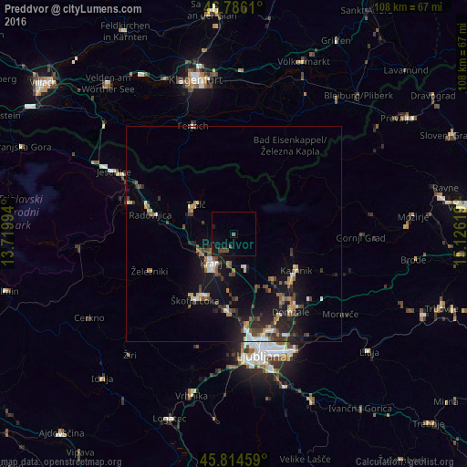
Analysis of Preddvor night lights 2016
Square area 10x10 km:
 0%
0%90-99
0%80-89
0%70-79
0%60-69
0%50-59
1.49%40-49
2.53%30-39
0%20-29
0.3%10-19
5.36%0-9
90.33%Square area 50x50 km:
0.43%90-99
0.68%80-89
0.51%70-79
0.56%60-69
0.8%50-59
0.83%40-49
1.22%30-39
0.96%20-29
1.63%10-19
5.43%0-9
86.95%Clear (daylight) street map image can be seen on geolist.org.
Map coordinates:
46° 47' 10" North, 13° 43' 11.8" East
46° 18' 9" North, 14° 25' 23" East
45° 48' 52.5" North, 15° 7' 34.3" East
Some cities around Preddvor sort by population:
• Kranj
8.8 km =5.5 mi,  216°
216°
• Tržič
11 km =6.8 mi,  308°
308°
• Šenčur
6.3 km =3.9 mi,  182°
182°
• Naklo
8.8 km =5.5 mi,  247°
247°
• Cerklje na Gorenjskem
7.4 km =4.6 mi,  136°
136°
• Vodice
13.7 km =8.5 mi,  156°
156°
• Komenda
14 km =8.7 mi, 140°
• Zgornje Jezersko
12 km =7.5 mi,  32°
32°
3192560 (p: 837)
Sources (retrieved 2019-11-25):
» Earth at Night: Flat Maps 2012, 2016