Murska Sobota night lights from space
Night Light of Murska Sobota from space (Slovenia) Src. Average luminocity for 10x10km area is 14.7088% and for 50x50km: 2.1575%.
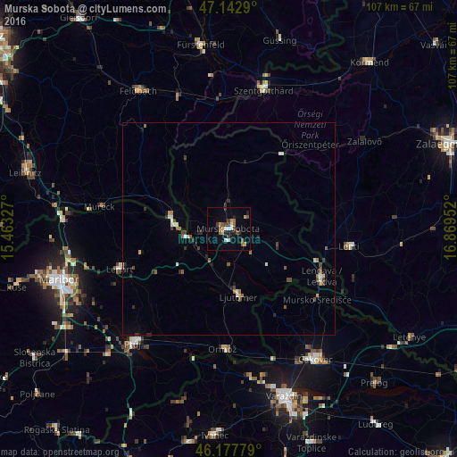
Analysis of Murska Sobota night lights 2016
Square area 10x10 km:
 1.7%
1.7%90-99
1.7%80-89
1.7%70-79
1.14%60-69
2.27%50-59
2.7%40-49
2.41%30-39
2.7%20-29
1.14%10-19
4.12%0-9
78.41%Square area 50x50 km:
0.15%90-99
0.4%80-89
0.15%70-79
0.11%60-69
0.3%50-59
0.44%40-49
0.39%30-39
0.4%20-29
0.39%10-19
0.38%0-9
96.9%Clear (daylight) street map image can be seen on geolist.org.
Map coordinates:
47° 8' 34.4" North, 15° 27' 47.8" East
46° 39' 45" North, 16° 9' 59" East
46° 10' 40" North, 16° 52' 10.3" East
Some cities around Murska Sobota sort by population:
• Beltinci
8.5 km =5.3 mi,  138°
138°
• Radenci
10.1 km =6.3 mi,  256°
256°
• Odranci
12.1 km =7.5 mi,  134°
134°
• Veržej
8.8 km =5.5 mi,  180°
180°
• Moravske Toplice
4.7 km =2.9 mi,  61°
61°
• Puconci
5 km =3.1 mi,  351°
351°
• Križevci pri Ljutomeru
10.7 km =6.6 mi,  191°
191°
• Tišina
5.7 km =3.5 mi,  265°
265°
3194648 (p: 11,614)
Sources (retrieved 2019-11-25):
» Earth at Night: Flat Maps 2012, 2016