Radenci night lights from space
Night Light of Radenci from space (Slovenia) Src. Average luminocity for 10x10km area is 9.4659% and for 50x50km: 2.7852%.
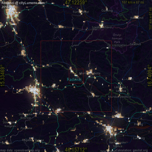
Analysis of Radenci night lights 2016
Square area 10x10 km:
 0.85%
0.85%90-99
2.7%80-89
0.43%70-79
0%60-69
0%50-59
2.27%40-49
0.85%30-39
3.27%20-29
2.98%10-19
0.14%0-9
86.51%Square area 50x50 km:
0.28%90-99
0.41%80-89
0.19%70-79
0.12%60-69
0.33%50-59
0.55%40-49
0.45%30-39
0.53%20-29
0.6%10-19
1.07%0-9
95.47%Clear (daylight) street map image can be seen on geolist.org.
Map coordinates:
47° 7' 21.3" North, 15° 20' 4.9" East
46° 38' 31.2" North, 16° 2' 16.1" East
46° 9' 25.6" North, 16° 44' 27.4" East
Some cities around Radenci sort by population:
• Murska Sobota
10.1 km =6.3 mi,  76°
76°
• Gornja Radgona
4.9 km =3 mi,  315°
315°
• Apače
11.5 km =7.1 mi,  302°
302°
• Križevci pri Ljutomeru
11.2 km =7 mi,  136°
136°
• Cankova
8.8 km =5.5 mi,  352°
352°
• Tišina
4.5 km =2.8 mi,  66°
66°
• Sveti Jurij ob Ščavnici
8.1 km =5 mi,  187°
187°
• Cerkvenjak
10.7 km =6.6 mi,  222°
222°
3192139 (p: 2,201)
Sources (retrieved 2019-11-25):
» Earth at Night: Flat Maps 2012, 2016