Kobarid night lights from space
Night Light of Kobarid from space (Slovenia) Src. Average luminocity for 10x10km area is 0.2113% and for 50x50km: 2.4821%.
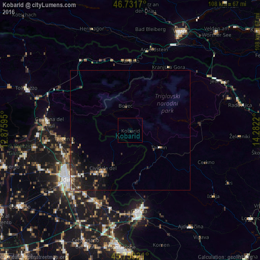
Analysis of Kobarid night lights 2016
Square area 10x10 km:
 0%
0%90-99
0%80-89
0%70-79
0%60-69
0%50-59
0%40-49
0%30-39
0.6%20-29
0%10-19
0%0-9
99.4%Square area 50x50 km:
0.07%90-99
0.41%80-89
0.1%70-79
0.25%60-69
0.28%50-59
0.38%40-49
0.6%30-39
0.68%20-29
1.05%10-19
2.65%0-9
93.55%Clear (daylight) street map image can be seen on geolist.org.
Map coordinates:
46° 43' 54.1" North, 12° 52' 33.4" East
46° 14' 51.4" North, 13° 34' 44.7" East
45° 45' 33.2" North, 14° 16' 55.9" East
Some cities around Kobarid sort by population:
• Cividale del Friuli, IT
21 km =13 mi,  213°
213°
• Tarcento, IT
28.3 km =17.6 mi,  262°
262°
• Tolmin
13.9 km =8.6 mi,  121°
121°
• Bohinjska Bistrica
28.9 km =18 mi,  84°
84°
• Bovec
10.3 km =6.4 mi,  348°
348°
• Kranjska Gora
27.8 km =17.3 mi,  33°
33°
• Kanal
18.3 km =11.4 mi,  165°
165°
• Dobrovo
28.2 km =17.5 mi,  188°
188°
3197983 (p: 1,121)
Sources (retrieved 2019-11-25):
» Earth at Night: Flat Maps 2012, 2016