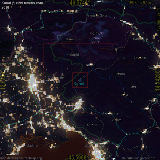
Kanal night lights from space
Night Light of Kanal from space (Slovenia) Src. Average luminocity for 10x10km area is 0.7216% and for 50x50km: 6.5253%.
Analysis of Kanal night lights 2016
Square area 10x10 km:
 0%
0%90-99
0%80-89
0%70-79
0%60-69
0%50-59
0%40-49
0%30-39
0.99%20-29
0.71%10-19
1.14%0-9
97.16%Square area 50x50 km:
0.66%90-99
1.09%80-89
0.46%70-79
0.53%60-69
0.77%50-59
0.72%40-49
1.08%30-39
0.9%20-29
1.76%10-19
10.34%0-9
81.68%Clear (daylight) street map image can be seen on geolist.org.
Map coordinates:
46° 34' 26.8" North, 12° 56' 11.8" East
46° 5' 19" North, 13° 38' 23" East
45° 35' 55.7" North, 14° 20' 34.3" East
Some cities around Kanal sort by population:
• Gorizia, IT
16.5 km =10.3 mi,  184°
184°
• Nova Gorica
14.8 km =9.2 mi, 177°
• Cividale del Friuli, IT
16.3 km =10.1 mi,  270°
270°
• Cormons, IT
19.9 km =12.4 mi,  222°
222°
• Šempeter pri Gorici
17.9 km =11.1 mi, 179°
• Tolmin
12.7 km =7.9 mi,  34°
34°
• Kobarid
18.3 km =11.4 mi,  345°
345°
• Dobrovo
13.5 km =8.4 mi, 220°
3198354 (p: 1,269)
Sources (retrieved 2019-11-25):
» Earth at Night: Flat Maps 2012, 2016