Jesenice night lights from space
Night Light of Jesenice from space (Slovenia) Src. Average luminocity for 10x10km area is 9.6235% and for 50x50km: 4.5366%.
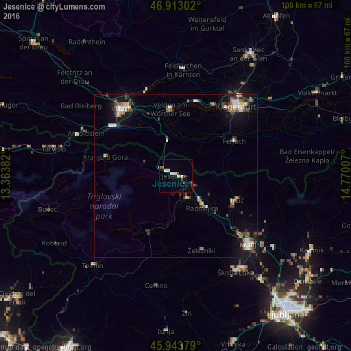
Analysis of Jesenice night lights 2016
Square area 10x10 km:
 1.34%
1.34%90-99
2.23%80-89
1.19%70-79
0.89%60-69
0%50-59
1.04%40-49
2.08%30-39
0.74%20-29
0.89%10-19
0.6%0-9
88.99%Square area 50x50 km:
0.52%90-99
0.72%80-89
0.48%70-79
0.39%60-69
0.58%50-59
0.66%40-49
0.82%30-39
0.69%20-29
0.65%10-19
3.41%0-9
91.08%Clear (daylight) street map image can be seen on geolist.org.
Map coordinates:
46° 54' 46.9" North, 13° 21' 49.8" East
46° 25' 50" North, 14° 4' 1" East
45° 56' 37.6" North, 14° 46' 12.3" East
Some cities around Jesenice sort by population:
• Finkenstein am Faaker See, AT
19.4 km =12.1 mi,  328°
328°
• Radovljica
12.6 km =7.8 mi,  139°
139°
• Bled
7.7 km =4.8 mi,  152°
152°
• Tržič
20.1 km =12.5 mi,  111°
111°
• Bohinjska Bistrica
19.6 km =12.2 mi,  206°
206°
• Kranjska Gora
22.3 km =13.9 mi,  277°
277°
• Žirovnica
6.3 km =3.9 mi,  117°
117°
• Zgornje Gorje
5.7 km =3.5 mi,  178°
178°
3198647 (p: 13,440)
Sources (retrieved 2019-11-25):
» Earth at Night: Flat Maps 2012, 2016