Växjö night lights from space
Night Light of Växjö (Kronoberg) from space (Sweden) Src. Average luminocity for 10x10km area is 49.5625% and for 50x50km: 3.5918%.
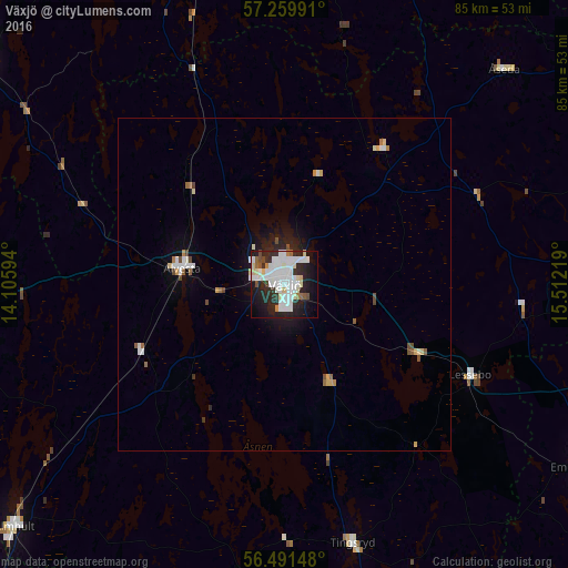
Analysis of Växjö night lights 2016
Square area 10x10 km:
 17.16%
90-99
16.14%80-89
4.2%70-79
0.45%60-69
2.5%50-59
1.93%40-49
2.05%30-39
3.3%20-29
17.84%10-19
21.7%0-9
12.73%Square area 50x50 km:
0.85%90-99
0.89%80-89
0.36%70-79
0.12%60-69
0.3%50-59
0.26%40-49
0.36%30-39
0.18%20-29
0.94%10-19
2.15%0-9
93.59%Clear (daylight) street map image can be seen on geolist.org.
Map coordinates:
57° 15' 35.7" North, 14° 6' 21.4" East
56° 52' 39.6" North, 14° 48' 32.6" East
56° 29' 29.3" North, 15° 30' 43.9" East
Some cities around Växjö sort by population:
• Värnamo
57.8 km =35.9 mi,  306°
306°
• Ljungby
53 km =32.9 mi,  264°
264°
• Vetlanda
63.4 km =39.4 mi,  14°
14°
• Nybro
68.5 km =42.6 mi,  102°
102°
• Älmhult
54.7 km =34 mi,  228°
228°
• Alvesta
15.6 km =9.7 mi,  278°
278°
• Olofström
68.8 km =42.8 mi,  194°
194°
• Sävsjö
59.1 km =36.7 mi,  351°
351°
2663536 (p: 65,383)
Sources (retrieved 2019-11-25):
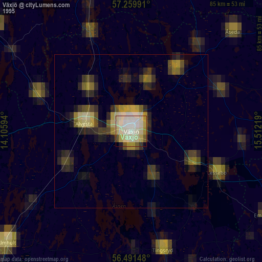
» NASA, Earths city lights 1995
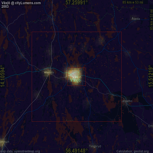
» NASA city lights 2003
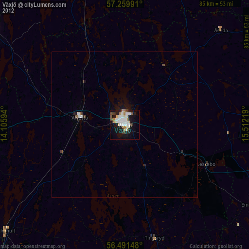
» Earth at Night: Flat Maps 2012, 2016