Älmhult night lights from space
Night Light of Älmhult (Kronoberg) from space (Sweden) Src. Average luminocity for 10x10km area is 12.4% and for 50x50km: 0.99%.
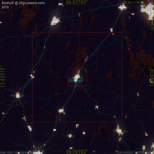
Analysis of Älmhult night lights 2016
Square area 10x10 km:
 1.93%
1.93%90-99
3.52%80-89
1.36%70-79
0.11%60-69
1.82%50-59
1.36%40-49
0.34%30-39
0.45%20-29
0.45%10-19
7.84%0-9
80.8%Square area 50x50 km:
0.1%90-99
0.23%80-89
0.12%70-79
0.04%60-69
0.17%50-59
0.17%40-49
0.07%30-39
0.07%20-29
0.03%10-19
0.33%0-9
98.67%Clear (daylight) street map image can be seen on geolist.org.
Map coordinates:
56° 56' 13.3" North, 13° 26' 6.5" East
56° 33' 5.3" North, 14° 8' 17.8" East
56° 9' 42.9" North, 14° 50' 29" East
Some cities around Älmhult sort by population:
• Växjö
54.7 km =34 mi,  48°
48°
• Kristianstad
57.8 km =35.9 mi,  179°
179°
• Hässleholm
49.3 km =30.6 mi,  207°
207°
• Ljungby
33.6 km =20.9 mi,  338°
338°
• Alvesta
46.3 km =28.8 mi,  33°
33°
• Bromölla
56.7 km =35.2 mi,  158°
158°
• Osby
20.9 km =13 mi, 205°
• Olofström
39 km =24.2 mi,  141°
141°
2726576 (p: 9,495)
Sources (retrieved 2019-11-25):
» Earth at Night: Flat Maps 2012, 2016