Alvesta night lights from space
Night Light of Alvesta (Kronoberg) from space (Sweden) Src. Average luminocity for 10x10km area is 10.983% and for 50x50km: 3.4485%.
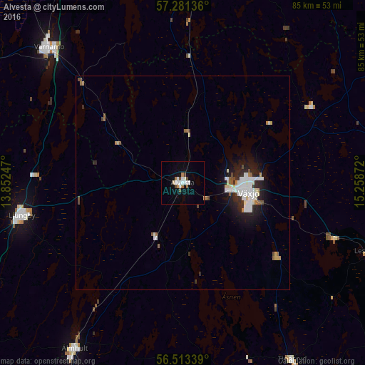
Analysis of Alvesta night lights 2016
Square area 10x10 km:
 2.16%
2.16%90-99
2.84%80-89
0.45%70-79
0.68%60-69
1.02%50-59
0.8%40-49
2.16%30-39
0.11%20-29
0%10-19
3.18%0-9
86.59%Square area 50x50 km:
0.83%90-99
0.86%80-89
0.29%70-79
0.14%60-69
0.3%50-59
0.26%40-49
0.32%30-39
0.18%20-29
1%10-19
2.15%0-9
93.68%Clear (daylight) street map image can be seen on geolist.org.
Map coordinates:
57° 16' 52.9" North, 13° 51' 8.9" East
56° 53' 57.7" North, 14° 33' 20.1" East
56° 30' 48.2" North, 15° 15' 31.4" East
Some cities around Alvesta sort by population:
• Växjö
15.6 km =9.7 mi,  98°
98°
• Värnamo
44.6 km =27.7 mi,  315°
315°
• Ljungby
38.1 km =23.7 mi,  258°
258°
• Vetlanda
66.8 km =41.5 mi,  28°
28°
• Älmhult
46.3 km =28.8 mi,  213°
213°
• Osby
67 km =41.6 mi, 210°
• Olofström
69.2 km =43 mi,  181°
181°
• Sävsjö
56.4 km =35 mi,  6°
6°
2726314 (p: 8,627)
Sources (retrieved 2019-11-25):
» Earth at Night: Flat Maps 2012, 2016