Aroma night lights from space
Night Light of Aroma (Kassala) from space (Sudan) Src. Average luminocity for 10x10km area is 0.5195% and for 50x50km: 0.0197%.
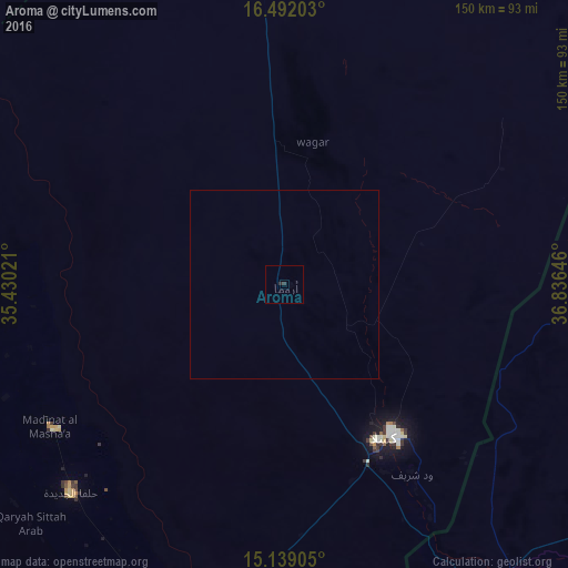
Analysis of Aroma night lights 2016
Square area 10x10 km:
 0%
0%90-99
0%80-89
0%70-79
0%60-69
0%50-59
0%40-49
0%30-39
0.87%20-29
0.87%10-19
0%0-9
98.27%Square area 50x50 km:
0%90-99
0%80-89
0%70-79
0%60-69
0%50-59
0%40-49
0%30-39
0.03%20-29
0.03%10-19
0%0-9
99.93%Clear (daylight) street map image can be seen on geolist.org.
Map coordinates:
16° 29' 31.3" North, 35° 25' 48.8" East
15° 49' 0" North, 36° 7' 60" East
15° 8' 20.6" North, 36° 50' 11.3" East
Some cities around Aroma sort by population:
• Kassala
49.7 km =30.9 mi,  144°
144°
• Al Qadarif
213.9 km =132.9 mi,  202°
202°
• Keren, ER
248 km =154.1 mi,  90°
90°
• Inda Silasē, ET
299.4 km =186 mi,  129°
129°
• Doka
258.8 km =160.8 mi,  188°
188°
• Barentu, ER
175 km =108.7 mi,  116°
116°
• Wagar
38.1 km =23.7 mi,  11°
11°
• Ak’ordat, ER
189.7 km =117.9 mi,  99°
99°
378502 (p: 12,708)
Sources (retrieved 2019-11-25):
» Earth at Night: Flat Maps 2012, 2016