Yermolino night lights from space
Night Light of Yermolino (Kaluga) from space (Russia) Src. Average luminocity for 10x10km area is 43.5376% and for 50x50km: 8.6543%.
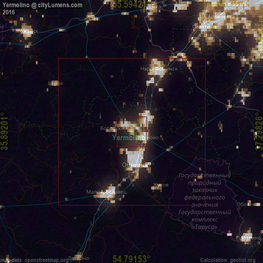
Analysis of Yermolino night lights 2016
Square area 10x10 km:
 6.02%
6.02%90-99
7.77%80-89
4.14%70-79
5.01%60-69
8.52%50-59
5.01%40-49
4.51%30-39
14.41%20-29
16.67%10-19
23.31%0-9
4.64%Square area 50x50 km:
1.42%90-99
1.68%80-89
0.71%70-79
0.55%60-69
0.99%50-59
1.06%40-49
1.03%30-39
1.48%20-29
2.99%10-19
7.2%0-9
80.87%Clear (daylight) street map image can be seen on geolist.org.
Map coordinates:
55° 35' 39.2" North, 35° 53' 31.2" East
55° 11' 41.6" North, 36° 35' 42.5" East
54° 47' 29.5" North, 37° 17' 53.7" East
Some cities around Yermolino sort by population:
• Obninsk
10.9 km =6.8 mi,  175°
175°
• Naro-Fominsk
23.1 km =14.4 mi,  22°
22°
• Maloyaroslavets
21.5 km =13.4 mi,  201°
201°
• Balabanovo
4.4 km =2.7 mi,  109°
109°
• Zhukovo
20.5 km =12.7 mi,  152°
152°
• Borovsk
7 km =4.3 mi,  280°
280°
• Kievskiy
31.3 km =19.4 mi,  33°
33°
• Belousovo
12.2 km =7.6 mi,  155°
155°
467238 (p: 10,100)
Sources (retrieved 2019-11-25):
» Earth at Night: Flat Maps 2012, 2016