Kievskiy night lights from space
Night Light of Kievskiy (Moscow Oblast) from space (Russia) Src. Average luminocity for 10x10km area is 16.7285% and for 50x50km: 19.4171%.
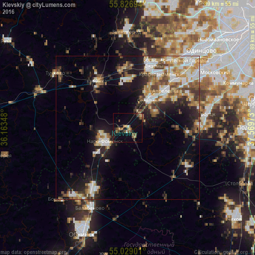
Analysis of Kievskiy night lights 2016
Square area 10x10 km:
 0.24%
0.24%90-99
0.84%80-89
1.2%70-79
2.03%60-69
3.95%50-59
4.31%40-49
3.47%30-39
2.03%20-29
2.99%10-19
12.92%0-9
66.03%Square area 50x50 km:
3.22%90-99
3.69%80-89
1.98%70-79
2.25%60-69
2.81%50-59
2.79%40-49
3.16%30-39
2.54%20-29
4.37%10-19
10.58%0-9
62.61%Clear (daylight) street map image can be seen on geolist.org.
Map coordinates:
55° 49' 37" North, 36° 9' 48.5" East
55° 25' 48" North, 36° 51' 59.8" East
55° 1' 44.4" North, 37° 34' 11" East
Some cities around Kievskiy sort by population:
• Naro-Fominsk
9.7 km =6 mi,  240°
240°
• Krasnoznamensk
21.7 km =13.5 mi,  29°
29°
• Kubinka
19.5 km =12.1 mi,  328°
328°
• Aprelevka
19.1 km =11.9 mi,  44°
44°
• Golitsyno
21.2 km =13.2 mi,  20°
20°
• Selyatino
11.8 km =7.3 mi, 36°
• Kokoshkino
26.7 km =16.6 mi,  45°
45°
• LMS
23.9 km =14.9 mi,  122°
122°
6697077 (p: 9,700)
Sources (retrieved 2019-11-25):
» Earth at Night: Flat Maps 2012, 2016