Vol’sk night lights from space
Night Light of Vol’sk (Saratovskaya Oblast) from space (Russia) Src. Average luminocity for 10x10km area is 9.5114% and for 50x50km: 0.6234%.
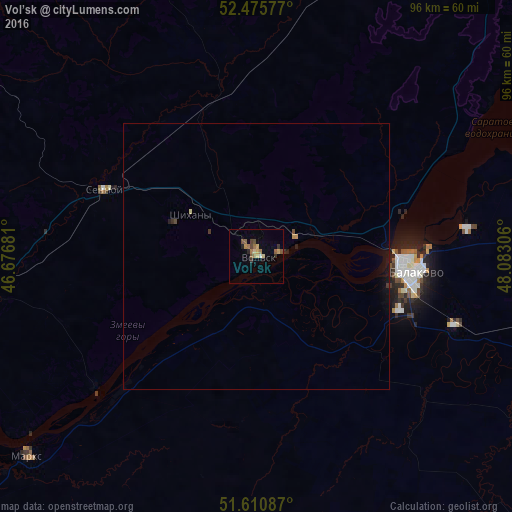

Analysis of Vol’sk night lights 2016
Square area 10x10 km:
 0%
0%90-99
0.51%80-89
1.14%70-79
1.89%60-69
2.78%50-59
2.15%40-49
1.77%30-39
1.64%20-29
0.76%10-19
0.51%0-9
86.87%Square area 50x50 km:
0%90-99
0.02%80-89
0.07%70-79
0.11%60-69
0.13%50-59
0.09%40-49
0.12%30-39
0.14%20-29
0.08%10-19
0.36%0-9
98.88%Clear (daylight) street map image can be seen on geolist.org.
Map coordinates:
52° 28' 32.8" North, 46° 40' 36.5" East
52° 2' 43.5" North, 47° 22' 47.7" East
51° 36' 39.1" North, 48° 4' 59" East
Some cities around Vol’sk sort by population:
• Balakovo
28.8 km =17.9 mi,  93°
93°
• Marks
57.1 km =35.5 mi,  229°
229°
• Khvalynsk
69.9 km =43.4 mi,  44°
44°
• Bazarnyy Karabulak
70.4 km =43.7 mi,  290°
290°
• Sennoy
30.8 km =19.1 mi, 292°
• Shikhany
14.8 km =9.2 mi,  302°
302°
• Pavlovka
73.5 km =45.7 mi,  347°
347°
• Dukhovnitskoye
74.7 km =46.4 mi,  49°
49°
472278 (p: 70,500)
Sources (retrieved 2019-11-25):
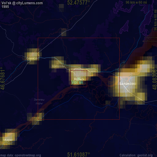
» NASA, Earths city lights 1995
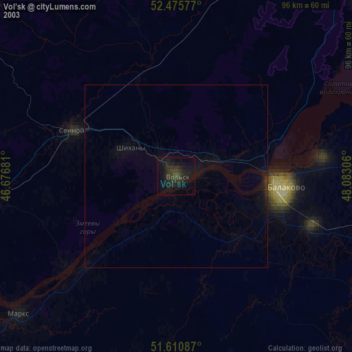
» NASA city lights 2003
» Earth at Night: Flat Maps 2012, 2016