Urkarakh night lights from space
Night Light of Urkarakh (Dagestan) from space (Russia) Src. Average luminocity for 10x10km area is 0.5894% and for 50x50km: 1.1672%.
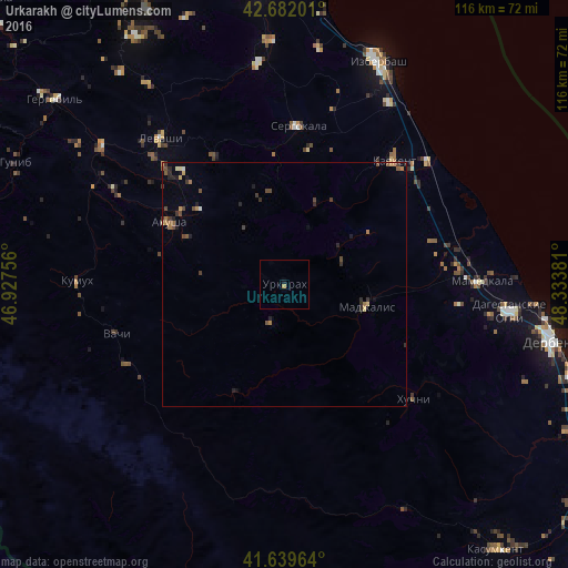
Analysis of Urkarakh night lights 2016
Square area 10x10 km:
 0%
0%90-99
0%80-89
0%70-79
0.15%60-69
0.45%50-59
0%40-49
0%30-39
0%20-29
0%10-19
0.61%0-9
98.79%Square area 50x50 km:
0%90-99
0.06%80-89
0.14%70-79
0.16%60-69
0.25%50-59
0.18%40-49
0.34%30-39
0.36%20-29
0.37%10-19
0.25%0-9
97.89%Clear (daylight) street map image can be seen on geolist.org.
Map coordinates:
42° 40' 55.2" North, 46° 55' 39.2" East
42° 9' 46.7" North, 47° 37' 50.4" East
41° 38' 22.7" North, 48° 20' 1.7" East
Some cities around Urkarakh sort by population:
• Kayakent
33.5 km =20.8 mi,  41°
41°
• Mamedkala
40.1 km =24.9 mi,  89°
89°
• Sergokala
32.5 km =20.2 mi,  4°
4°
• Levashi
39.1 km =24.3 mi,  319°
319°
• Gedzhukh
36 km =22.4 mi,  96°
96°
• Madzhalis
17.3 km =10.7 mi,  105°
105°
• Novokayakent
38.9 km =24.2 mi,  48°
48°
• Ulluaya
31.5 km =19.6 mi, 318°
478711 (p: 5,548)
Sources (retrieved 2019-11-25):
» Earth at Night: Flat Maps 2012, 2016