Apatity night lights from space
Night Light of Apatity (Murmansk) from space (Russia) Src. Average luminocity for 10x10km area is 20.7355% and for 50x50km: 3.0274%.
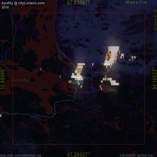
Analysis of Apatity night lights 2016
Square area 10x10 km:
 3.66%
3.66%90-99
5.53%80-89
1.7%70-79
1.53%60-69
3.74%50-59
2.55%40-49
0%30-39
0%20-29
3.32%10-19
21.51%0-9
56.46%Square area 50x50 km:
0.51%90-99
0.69%80-89
0.35%70-79
0.28%60-69
0.4%50-59
0.17%40-49
0.03%30-39
0.08%20-29
0.85%10-19
3.11%0-9
93.51%Clear (daylight) street map image can be seen on geolist.org.
Map coordinates:
67° 49' 51.5" North, 32° 41' 59.9" East
67° 33' 50.9" North, 33° 24' 11.2" East
67° 17' 39.4" North, 34° 6' 22.4" East
Some cities around Apatity sort by population:
• Monchegorsk
47.3 km =29.4 mi,  331°
331°
• Kandalaksha
61.6 km =38.3 mi,  223°
223°
• Kirovsk
12.7 km =7.9 mi,  63°
63°
• Olenegorsk
64.7 km =40.2 mi,  354°
354°
• Polyarnyye Zori
44.4 km =27.6 mi,  240°
240°
• Revda
64 km =39.8 mi,  49°
49°
• Zelenoborskiy
91.7 km =57 mi,  209°
209°
• Vysokiy
63.6 km =39.5 mi,  0°
0°
581357 (p: 61,186)
Sources (retrieved 2019-11-25):
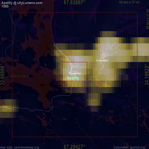
» NASA, Earths city lights 1995
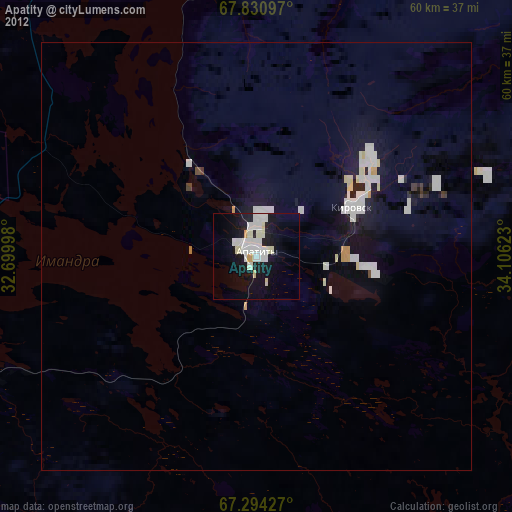
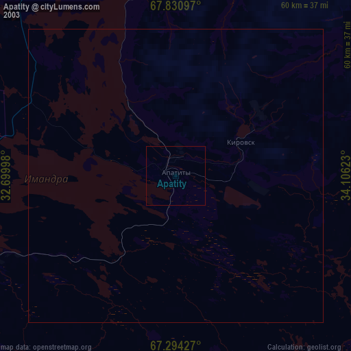
» NASA city lights 2003
» Earth at Night: Flat Maps 2012, 2016