Tavrichanka night lights from space
Night Light of Tavrichanka (Primorskiy (Maritime) Kray) from space (Russia) Src. Average luminocity for 10x10km area is 0.0015% and for 50x50km: 9.5621%.
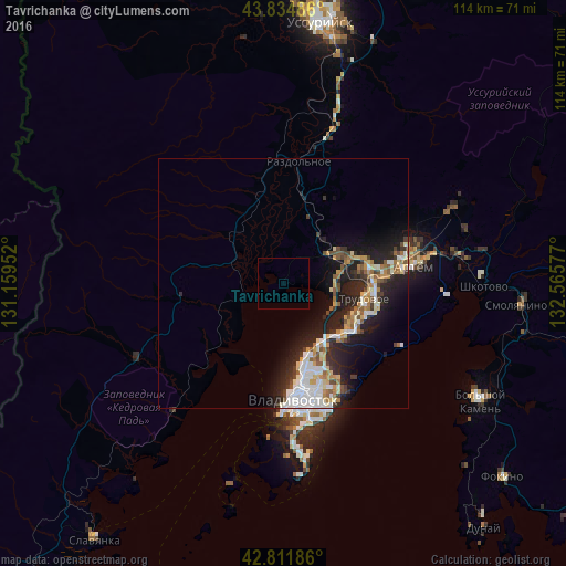
Analysis of Tavrichanka night lights 2016
Square area 10x10 km:
 0%
0%90-99
0%80-89
0%70-79
0%60-69
0%50-59
0%40-49
0%30-39
0%20-29
0%10-19
0%0-9
100%Square area 50x50 km:
1.9%90-99
1.75%80-89
1.1%70-79
0.95%60-69
1.08%50-59
1.22%40-49
0.91%30-39
1.23%20-29
3.47%10-19
6.45%0-9
79.95%Clear (daylight) street map image can be seen on geolist.org.
Map coordinates:
43° 50' 5.5" North, 131° 9' 34.3" East
43° 19' 31.8" North, 131° 51' 45.5" East
42° 48' 42.7" North, 132° 33' 56.8" East
Some cities around Tavrichanka sort by population:
• Vladivostok
24.5 km =15.2 mi,  177°
177°
• Artëm
26.6 km =16.5 mi,  81°
81°
• Trudovoye
17 km =10.6 mi,  100°
100°
• Uglovoye
18.3 km =11.4 mi,  89°
89°
• Razdol’noye
23.9 km =14.9 mi,  6°
6°
• Vol’no-Nadezhdinskoye
12.2 km =7.6 mi,  63°
63°
• Novyy
13.5 km =8.4 mi,  71°
71°
• Russkiy
33.7 km =20.9 mi, 180°
2015455 (p: 8,352)
Sources (retrieved 2019-11-25):
» Earth at Night: Flat Maps 2012, 2016