Artëm night lights from space
Night Light of Artëm (Primorskiy (Maritime) Kray) from space (Russia) Src. Average luminocity for 10x10km area is 34.2286% and for 50x50km: 9.1196%.
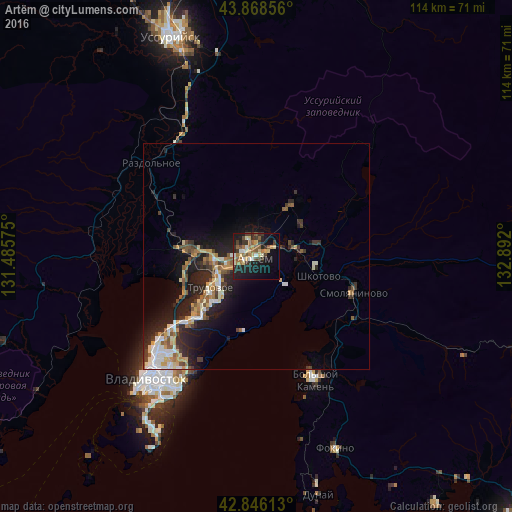
Analysis of Artëm night lights 2016
Square area 10x10 km:
 2.38%
2.38%90-99
4.44%80-89
8.41%70-79
1.9%60-69
7.3%50-59
5.56%40-49
3.65%30-39
7.62%20-29
9.37%10-19
25.87%0-9
23.49%Square area 50x50 km:
1.06%90-99
1.4%80-89
1.27%70-79
1%60-69
1.13%50-59
1.47%40-49
0.98%30-39
1.65%20-29
3.45%10-19
6.51%0-9
80.1%Clear (daylight) street map image can be seen on geolist.org.
Map coordinates:
43° 52' 6.8" North, 131° 29' 8.7" East
43° 21' 34.2" North, 132° 11' 19.9" East
42° 50' 46.1" North, 132° 53' 31.2" East
Some cities around Artëm sort by population:
• Trudovoye
11.9 km =7.4 mi,  234°
234°
• Zavodskoy
13.8 km =8.6 mi,  34°
34°
• Uglovoye
8.8 km =5.5 mi,  246°
246°
• Tavrichanka
26.6 km =16.5 mi,  261°
261°
• Vol’no-Nadezhdinskoye
15.6 km =9.7 mi,  276°
276°
• Smolyaninovo
23 km =14.3 mi,  110°
110°
• Novyy
13.6 km =8.5 mi,  272°
272°
• Shkotovo
14.1 km =8.8 mi, 107°
2027456 (p: 102,300)
Sources (retrieved 2019-11-25):
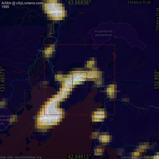
» NASA, Earths city lights 1995
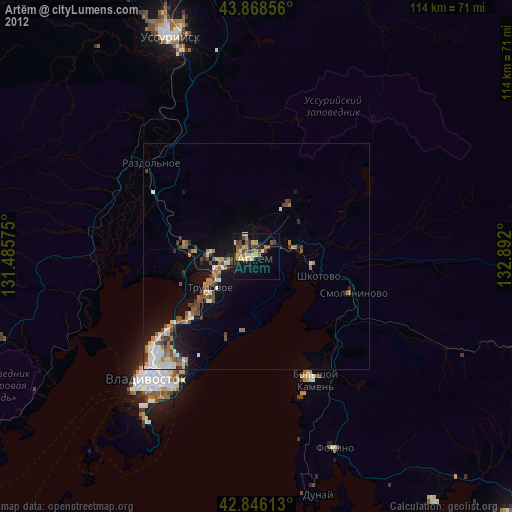
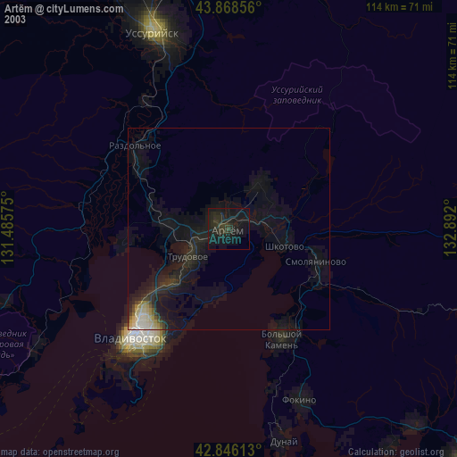
» NASA city lights 2003
» Earth at Night: Flat Maps 2012, 2016