Vol’no-Nadezhdinskoye night lights from space
Night Light of Vol’no-Nadezhdinskoye (Primorskiy (Maritime) Kray) from space (Russia) Src. Average luminocity for 10x10km area is 18.1794% and for 50x50km: 8.2234%.
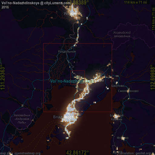
Analysis of Vol’no-Nadezhdinskoye night lights 2016
Square area 10x10 km:
 0%
0%90-99
0%80-89
2.54%70-79
2.7%60-69
3.97%50-59
4.76%40-49
3.49%30-39
5.87%20-29
3.97%10-19
17.78%0-9
54.92%Square area 50x50 km:
0.87%90-99
1.17%80-89
1.14%70-79
0.87%60-69
1.07%50-59
1.38%40-49
0.89%30-39
1.35%20-29
3.42%10-19
6.66%0-9
81.18%Clear (daylight) street map image can be seen on geolist.org.
Map coordinates:
43° 53' 2" North, 131° 17' 37.1" East
43° 22' 29.9" North, 131° 59' 48.3" East
42° 51' 42.2" North, 132° 41' 59.6" East
Some cities around Vol’no-Nadezhdinskoye sort by population:
• Artëm
15.6 km =9.7 mi,  96°
96°
• Trudovoye
10.3 km =6.4 mi,  145°
145°
• Zavodskoy
25.2 km =15.7 mi,  67°
67°
• Uglovoye
9.1 km =5.7 mi,  125°
125°
• Tavrichanka
12.2 km =7.6 mi,  243°
243°
• Razdol’noye
19.9 km =12.4 mi,  336°
336°
• Novyy
2.3 km =1.4 mi,  120°
120°
• Shkotovo
29.5 km =18.3 mi, 101°
2013332 (p: 6,577)
Sources (retrieved 2019-11-25):
» Earth at Night: Flat Maps 2012, 2016