Syzran’ night lights from space
Night Light of Syzran’ (Samara Oblast) from space (Russia) Src. Average luminocity for 10x10km area is 55.572% and for 50x50km: 5.0635%.
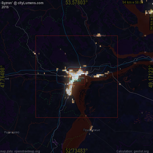

Analysis of Syzran’ night lights 2016
Square area 10x10 km:
 17.8%
17.8%90-99
14.77%80-89
6.82%70-79
2.27%60-69
3.66%50-59
3.66%40-49
3.91%30-39
6.69%20-29
21.59%10-19
14.02%0-9
4.8%Square area 50x50 km:
1.08%90-99
1.09%80-89
0.36%70-79
0.43%60-69
0.48%50-59
0.46%40-49
0.44%30-39
0.56%20-29
1.78%10-19
3.56%0-9
89.77%Clear (daylight) street map image can be seen on geolist.org.
Map coordinates:
53° 34' 40.9" North, 47° 45' 53.9" East
53° 9' 30.6" North, 48° 28' 5.2" East
52° 44' 5.4" North, 49° 10' 16.4" East
Some cities around Syzran’ sort by population:
• Tol’yatti
71.5 km =44.4 mi,  54°
54°
• Zhigulevsk
73.4 km =45.6 mi,  68°
68°
• Oktyabr’sk
15.5 km =9.6 mi,  86°
86°
• Bezenchuk
67.4 km =41.9 mi,  106°
106°
• Novospasskoye
47.8 km =29.7 mi,  268°
268°
• Kuzovatovo
67.5 km =41.9 mi,  309°
309°
• Obsharovka
25.9 km =16.1 mi,  98°
98°
• Shigony
29 km =18 mi,  28°
28°
484972 (p: 189,338)
Sources (retrieved 2019-11-25):
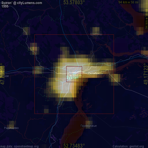
» NASA, Earths city lights 1995
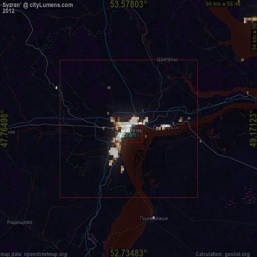
» NASA city lights 2003
» Earth at Night: Flat Maps 2012, 2016