Stavropol’ night lights from space
Night Light of Stavropol’ (Stavropol’ Kray) from space (Russia) Src. Average luminocity for 10x10km area is 76.1061% and for 50x50km: 7.0199%.
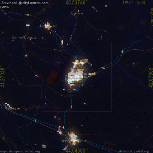
Analysis of Stavropol’ night lights 2016
Square area 10x10 km:
 28.03%
90-99
26.36%80-89
4.7%70-79
6.36%60-69
6.67%50-59
5.3%40-49
3.48%30-39
7.27%20-29
8.94%10-19
2.88%0-9
0%Square area 50x50 km:
1.5%90-99
1.55%80-89
0.49%70-79
0.51%60-69
0.87%50-59
0.74%40-49
0.95%30-39
0.96%20-29
2.19%10-19
4.14%0-9
86.11%Clear (daylight) street map image can be seen on geolist.org.
Map coordinates:
45° 32' 14.9" North, 41° 16' 13" East
45° 2' 34.1" North, 41° 58' 24.2" East
44° 32' 37.8" North, 42° 40' 35.5" East
Some cities around Stavropol’ sort by population:
• Mikhaylovsk
10.4 km =6.5 mi,  23°
23°
• Izobil’nyy
42 km =26.1 mi,  330°
330°
• Kochubeyevskoye
45.5 km =28.3 mi,  192°
192°
• Ryzdvyanyy
26.9 km =16.7 mi,  336°
336°
• Pelagiada
18.6 km =11.6 mi,  12°
12°
• Tatarka
9.5 km =5.9 mi, 190°
• Barsukovskaya
33.4 km =20.8 mi,  201°
201°
• Moskovskoye
27.3 km =17 mi,  349°
349°
487846 (p: 363,064)
Sources (retrieved 2019-11-25):
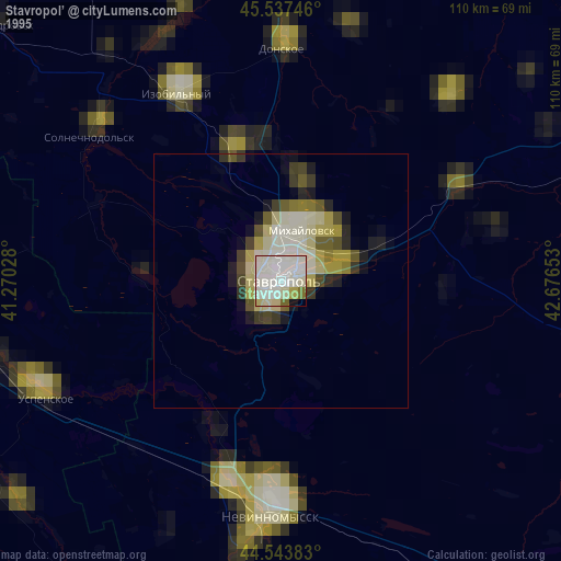
» NASA, Earths city lights 1995
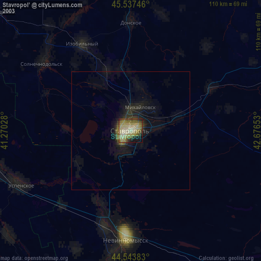
» NASA city lights 2003
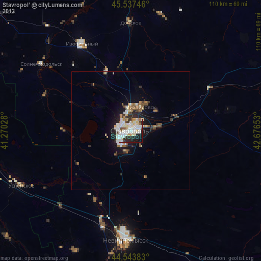
» Earth at Night: Flat Maps 2012, 2016