Tatarka night lights from space
Night Light of Tatarka (Stavropol’ Kray) from space (Russia) Src. Average luminocity for 10x10km area is 16.7825% and for 50x50km: 6.8318%.
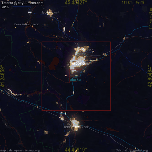
Analysis of Tatarka night lights 2016
Square area 10x10 km:
 2.54%
2.54%90-99
2.86%80-89
0.63%70-79
0%60-69
1.9%50-59
1.11%40-49
2.86%30-39
3.02%20-29
10.95%10-19
19.84%0-9
54.29%Square area 50x50 km:
1.46%90-99
1.51%80-89
0.46%70-79
0.48%60-69
0.85%50-59
0.69%40-49
0.98%30-39
0.94%20-29
2.22%10-19
4.12%0-9
86.3%Clear (daylight) street map image can be seen on geolist.org.
Map coordinates:
45° 27' 15.4" North, 41° 14' 54.9" East
44° 57' 32" North, 41° 57' 6.2" East
44° 27' 33.1" North, 42° 39' 17.4" East
Some cities around Tatarka sort by population:
• Stavropol’
9.5 km =5.9 mi,  10°
10°
• Nevinnomyssk
36.2 km =22.5 mi,  180°
180°
• Mikhaylovsk
19.7 km =12.2 mi,  17°
17°
• Kochubeyevskoye
36 km =22.4 mi,  193°
193°
• Ryzdvyanyy
35.2 km =21.9 mi,  345°
345°
• Pelagiada
28.1 km =17.5 mi, 11°
• Barsukovskaya
24.1 km =15 mi,  205°
205°
• Moskovskoye
36.3 km =22.6 mi, 354°
484162 (p: 6,062)
Sources (retrieved 2019-11-25):
» Earth at Night: Flat Maps 2012, 2016