Podgorenskiy night lights from space
Night Light of Podgorenskiy (Voronezj) from space (Russia) Src. Average luminocity for 10x10km area is 7.2017% and for 50x50km: 1.0487%.
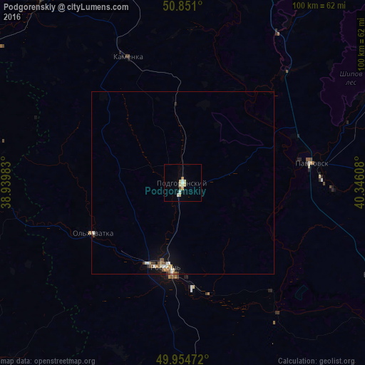
Analysis of Podgorenskiy night lights 2016
Square area 10x10 km:
 0.84%
0.84%90-99
0.84%80-89
3.36%70-79
0.56%60-69
0.56%50-59
0%40-49
0.56%30-39
0%20-29
0.28%10-19
0.84%0-9
92.16%Square area 50x50 km:
0.12%90-99
0.19%80-89
0.21%70-79
0.1%60-69
0.1%50-59
0.14%40-49
0.15%30-39
0.07%20-29
0.07%10-19
0.45%0-9
98.39%Clear (daylight) street map image can be seen on geolist.org.
Map coordinates:
50° 51' 3.6" North, 38° 56' 23.4" East
50° 24' 17.9" North, 39° 38' 34.6" East
49° 57' 17" North, 40° 20' 45.9" East
Some cities around Podgorenskiy sort by population:
• Rossosh’
23.6 km =14.7 mi,  193°
193°
• Liski
65 km =40.4 mi,  352°
352°
• Ostrogozhsk
65.1 km =40.5 mi,  322°
322°
• Pavlovsk
33.5 km =20.8 mi,  79°
79°
• Kamenka
37.8 km =23.5 mi,  335°
335°
• Verkhniy Mamon
59.1 km =36.7 mi,  117°
117°
• Mitrofanovka
48.4 km =30.1 mi,  175°
175°
• Vorontsovka
55.4 km =34.4 mi,  65°
65°
508394 (p: 6,652)
Sources (retrieved 2019-11-25):
» Earth at Night: Flat Maps 2012, 2016