Yaroslavskiy night lights from space
Night Light of Yaroslavskiy (Moscow) from space (Russia) Src. Average luminocity for 10x10km area is 83.599% and for 50x50km: 69.6946%.
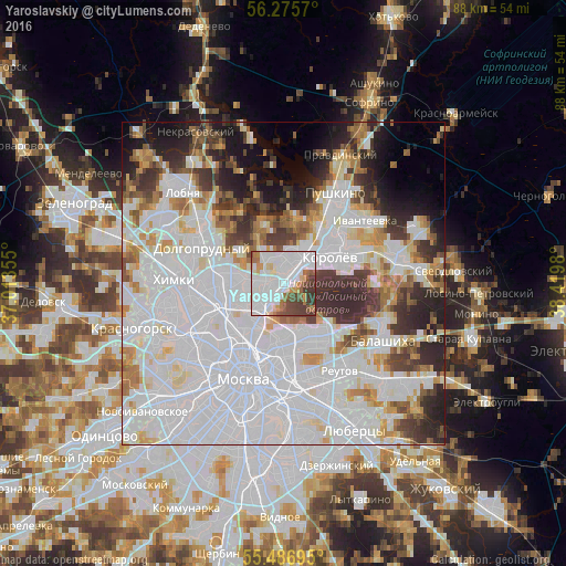
Analysis of Yaroslavskiy night lights 2016
Square area 10x10 km:
 41.48%
90-99
22.81%80-89
3.63%70-79
4.51%60-69
7.02%50-59
4.01%40-49
9.52%30-39
7.02%20-29
0%10-19
0%0-9
0%Square area 50x50 km:
35.46%90-99
15.06%80-89
4.82%70-79
4.59%60-69
4.88%50-59
3.91%40-49
4.04%30-39
6.29%20-29
7.02%10-19
6.29%0-9
7.62%Clear (daylight) street map image can be seen on geolist.org.
Map coordinates:
56° 16' 32.5" North, 37° 0' 48.8" East
55° 52' 60" North, 37° 43' 0" East
55° 29' 13" North, 38° 25' 11.3" East
Some cities around Yaroslavskiy sort by population:
• Mytishchi
3.3 km =2.1 mi,  15°
15°
• Bibirevo
7.3 km =4.5 mi,  270°
270°
• Babushkin
1.8 km =1.1 mi,  152°
152°
• Sviblovo
6.4 km =4 mi,  234°
234°
• Kozeyevo
6.5 km =4 mi,  253°
253°
• Vatutino
1.6 km =1 mi, 274°
• Rostokino
6.4 km =4 mi,  209°
209°
• Leonovo
5.6 km =3.5 mi, 228°
530088 (p: 91,000)
Sources (retrieved 2019-11-25):
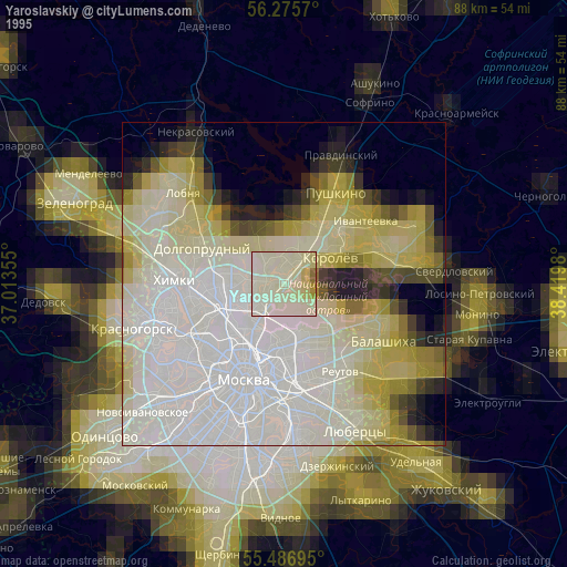
» NASA, Earths city lights 1995
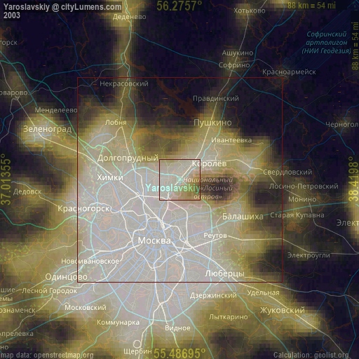
» NASA city lights 2003
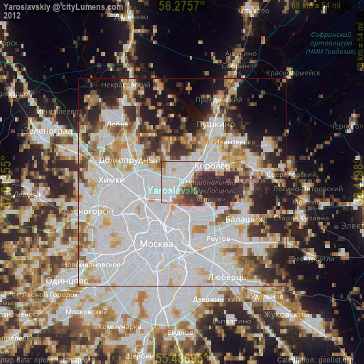
» Earth at Night: Flat Maps 2012, 2016