Ozherel’ye night lights from space
Night Light of Ozherel’ye (Moscow Oblast) from space (Russia) Src. Average luminocity for 10x10km area is 21.282% and for 50x50km: 4.5689%.
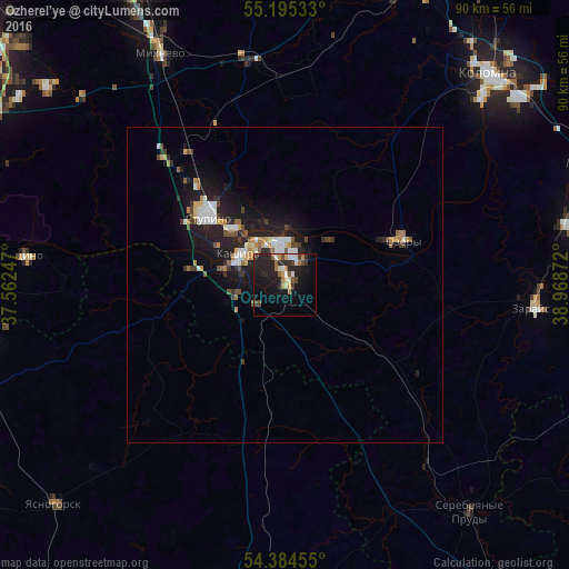
Analysis of Ozherel’ye night lights 2016
Square area 10x10 km:
 2.13%
2.13%90-99
2.51%80-89
2.38%70-79
2.13%60-69
3.26%50-59
2.13%40-49
3.01%30-39
2.51%20-29
11.9%10-19
22.18%0-9
45.86%Square area 50x50 km:
0.61%90-99
0.78%80-89
0.33%70-79
0.5%60-69
0.51%50-59
0.5%40-49
0.59%30-39
0.62%20-29
1.66%10-19
4.74%0-9
89.16%Clear (daylight) street map image can be seen on geolist.org.
Map coordinates:
55° 11' 43.2" North, 37° 33' 44.9" East
54° 47' 31.1" North, 38° 15' 56.1" East
54° 23' 4.4" North, 38° 58' 7.4" East
Some cities around Ozherel’ye sort by population:
• Kolomna
45.8 km =28.5 mi,  45°
45°
• Stupino
17.4 km =10.8 mi,  314°
314°
• Kashira
8.6 km =5.3 mi, 312°
• Ozëry
19.8 km =12.3 mi,  67°
67°
• Zaraysk
39.5 km =24.5 mi,  95°
95°
• Pushchino
42.2 km =26.2 mi,  276°
276°
• Mikhnëvo
42.3 km =26.3 mi,  331°
331°
• Serebryanyye Prudy
46.3 km =28.8 mi,  140°
140°
513362 (p: 10,618)
Sources (retrieved 2019-11-25):
» Earth at Night: Flat Maps 2012, 2016