Ozersk night lights from space
Night Light of Ozersk (Chelyabinsk) from space (Russia) Src. Average luminocity for 10x10km area is 19.9486% and for 50x50km: 3.1379%.
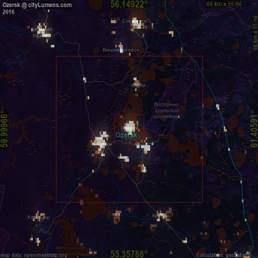
Analysis of Ozersk night lights 2016
Square area 10x10 km:
 4.31%
4.31%90-99
3.83%80-89
0.84%70-79
2.39%60-69
0.84%50-59
1.79%40-49
1.2%30-39
1.67%20-29
1.08%10-19
34.45%0-9
47.61%Square area 50x50 km:
0.66%90-99
0.63%80-89
0.18%70-79
0.22%60-69
0.25%50-59
0.29%40-49
0.23%30-39
0.16%20-29
0.29%10-19
3.3%0-9
93.78%Clear (daylight) street map image can be seen on geolist.org.
Map coordinates:
56° 8' 57.2" North, 59° 59' 58.8" East
55° 45' 20" North, 60° 42' 10" East
55° 21' 28.4" North, 61° 24' 21.3" East
Some cities around Ozersk sort by population:
• Snezhinsk
36.7 km =22.8 mi,  2°
2°
• Kyshtym
10.5 km =6.5 mi,  243°
243°
• Verkhniy Ufaley
44.1 km =27.4 mi,  319°
319°
• Kasli
15.5 km =9.6 mi,  13°
13°
• Karabash
43.2 km =26.8 mi,  225°
225°
• Argayash
31.6 km =19.6 mi,  159°
159°
• Novogornyy
15 km =9.3 mi, 158°
• Vishnëvogorsk
26.4 km =16.4 mi,  353°
353°
1538634 (p: 81,023)
Sources (retrieved 2019-11-25):
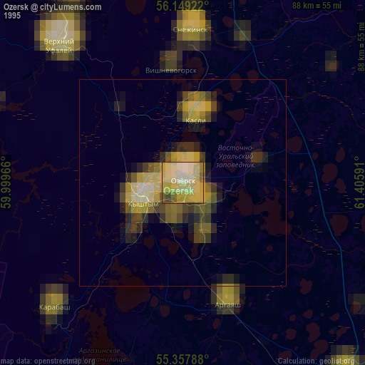
» NASA, Earths city lights 1995
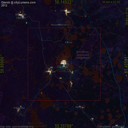
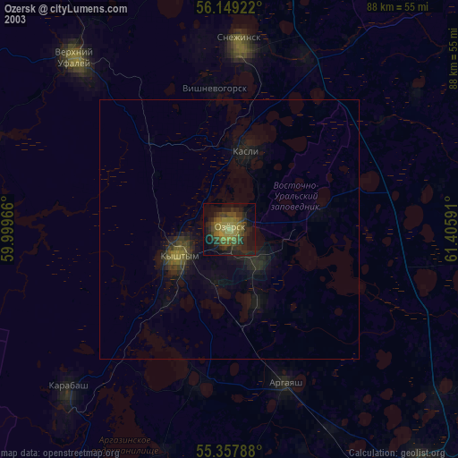
» NASA city lights 2003
» Earth at Night: Flat Maps 2012, 2016