Ol’gino night lights from space
Night Light of Ol’gino (Leningradskaya Oblast') from space (Russia) Src. Average luminocity for 10x10km area is 61.532% and for 50x50km: 31.0508%.
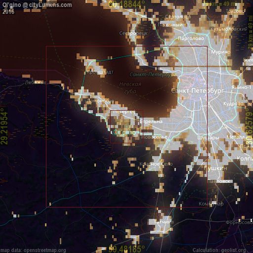
Analysis of Ol’gino night lights 2016
Square area 10x10 km:
 10.74%
90-99
17.25%80-89
8.26%70-79
7.02%60-69
7.23%50-59
13.74%40-49
2.69%30-39
11.36%20-29
15.91%10-19
5.37%0-9
0.41%Square area 50x50 km:
13.18%90-99
6.48%80-89
2.15%70-79
2.56%60-69
1.74%50-59
1.96%40-49
1.13%30-39
2.79%20-29
7.51%10-19
11.57%0-9
48.94%Clear (daylight) street map image can be seen on geolist.org.
Map coordinates:
60° 11' 18.4" North, 29° 13' 10.3" East
59° 50' 13.3" North, 29° 55' 21.6" East
59° 28' 54.7" North, 30° 37' 32.8" East
Some cities around Ol’gino sort by population:
• Peterhof
5.3 km =3.3 mi,  346°
346°
• Petrodvorets
9.4 km =5.8 mi,  313°
313°
• Uritsk
14.1 km =8.8 mi,  89°
89°
• Sosnovaya Polyana
12.5 km =7.8 mi, 90°
• Lomonosov
11.4 km =7.1 mi, 312°
• Gorelovo
13.9 km =8.6 mi,  121°
121°
• Strel'na
6.5 km =4 mi,  75°
75°
• Gorbunki
4.4 km =2.7 mi,  127°
127°
515558 (p: 7,600)
Sources (retrieved 2019-11-25):
» Earth at Night: Flat Maps 2012, 2016