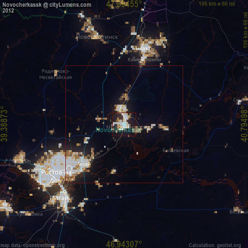
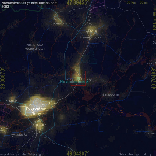
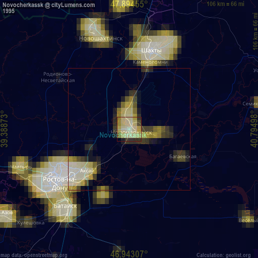
Novocherkassk night lights from space
Night Light of Novocherkassk (Rostov) from space (Russia) Src. Average luminocity for 10x10km area is 41.4844% and for 50x50km: 8.8894%.

Analysis of Novocherkassk night lights 2016
Square area 10x10 km:
 9.23%
9.23%90-99
9.8%80-89
4.26%70-79
3.84%60-69
3.13%50-59
2.84%40-49
3.27%30-39
4.55%20-29
19.18%10-19
35.51%0-9
4.4%Square area 50x50 km:
1.81%90-99
1.87%80-89
0.65%70-79
0.59%60-69
0.94%50-59
1.16%40-49
1.08%30-39
1.02%20-29
2.7%10-19
5.45%0-9
82.74%Clear (daylight) street map image can be seen on geolist.org.
Map coordinates:
47° 53' 40.4" North, 39° 23' 19.4" East
47° 25' 15.5" North, 40° 5' 30.7" East
46° 56' 35.1" North, 40° 47' 41.9" East
Some cities around Novocherkassk sort by population:
• Aksay
24.8 km =15.4 mi,  223°
223°
• Bagayevskaya
24.8 km =15.4 mi,  115°
115°
• Donskoy
12.5 km =7.8 mi,  93°
93°
• Kamenolomni
28.8 km =17.9 mi,  17°
17°
• Mayskiy
30.6 km =19 mi,  1°
1°
• Krivyanskaya
6.2 km =3.9 mi, 115°
• Ol’ginskaya
28.1 km =17.5 mi,  202°
202°
• Starocherkasskaya
20.4 km =12.7 mi,  190°
190°
518970 (p: 166,974)
Sources (retrieved 2019-11-25):
» NASA, Earths city lights 1995
» NASA city lights 2003
» Earth at Night: Flat Maps 2012, 2016