Aksay night lights from space
Night Light of Aksay (Rostov) from space (Russia) Src. Average luminocity for 10x10km area is 55.8408% and for 50x50km: 19.5858%.
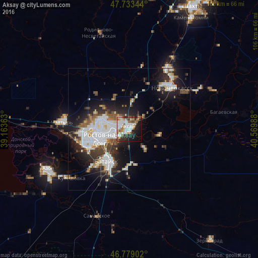
Analysis of Aksay night lights 2016
Square area 10x10 km:
 16.67%
90-99
15.33%80-89
5.21%70-79
3.13%60-69
7.44%50-59
5.8%40-49
3.57%30-39
5.51%20-29
13.1%10-19
16.67%0-9
7.59%Square area 50x50 km:
5.08%90-99
4.53%80-89
1.41%70-79
1.4%60-69
1.61%50-59
2.13%40-49
2.07%30-39
2.89%20-29
5.54%10-19
9.89%0-9
63.44%Clear (daylight) street map image can be seen on geolist.org.
Map coordinates:
47° 44' 0.4" North, 39° 9' 49.1" East
47° 15' 30.2" North, 39° 52' 0.3" East
46° 46' 44.5" North, 40° 34' 11.6" East
Some cities around Aksay sort by population:
• Rostov-na-Donu
11.2 km =7 mi,  254°
254°
• Novocherkassk
24.8 km =15.4 mi,  43°
43°
• Bataysk
15.8 km =9.8 mi,  213°
213°
• Chaltyr
29.2 km =18.1 mi,  275°
275°
• Kuleshovka
30.8 km =19.1 mi,  229°
229°
• Krivyanskaya
27.4 km =17 mi,  55°
55°
• Ol’ginskaya
10 km =6.2 mi,  141°
141°
• Starocherkasskaya
13.4 km =8.3 mi,  98°
98°
583673 (p: 38,871)
Sources (retrieved 2019-11-25):
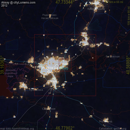
» Earth at Night: Flat Maps 2012, 2016