Aleksandriyskaya night lights from space
Night Light of Aleksandriyskaya (Stavropol’ Kray) from space (Russia) Src. Average luminocity for 10x10km area is 0.0197% and for 50x50km: 4.4707%.
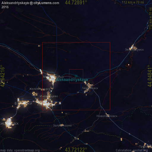
Analysis of Aleksandriyskaya night lights 2016
Square area 10x10 km:
 0%
0%90-99
0%80-89
0%70-79
0%60-69
0%50-59
0%40-49
0%30-39
0%20-29
0%10-19
0%0-9
100%Square area 50x50 km:
0.62%90-99
0.78%80-89
0.27%70-79
0.43%60-69
0.48%50-59
0.7%40-49
0.79%30-39
0.8%20-29
1.1%10-19
3.75%0-9
90.28%Clear (daylight) street map image can be seen on geolist.org.
Map coordinates:
44° 43' 44.1" North, 42° 38' 31.8" East
44° 13' 38" North, 43° 20' 43" East
43° 43' 16.4" North, 44° 2' 54.3" East
Some cities around Aleksandriyskaya sort by population:
• Mineralnye Vody
16.8 km =10.4 mi,  263°
263°
• Georgiyevsk
13 km =8.1 mi,  130°
130°
• Nezlobnaya
13 km =8.1 mi,  159°
159°
• Krasnokumskoye
13.6 km =8.5 mi,  113°
113°
• Lysogorskaya
14.5 km =9 mi,  202°
202°
• Levokumka
15.6 km =9.7 mi,  271°
271°
• Georgiyevskaya
17.4 km =10.8 mi,  137°
137°
• Podgornaya
7.2 km =4.5 mi, 111°
583368 (p: 10,279)
Sources (retrieved 2019-11-25):
» Earth at Night: Flat Maps 2012, 2016