Lyubinskiy night lights from space
Night Light of Lyubinskiy (Omsk) from space (Russia) Src. Average luminocity for 10x10km area is 0% and for 50x50km: 0.077%.
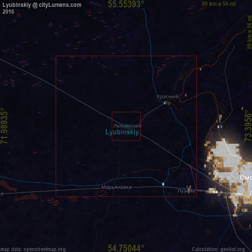
Analysis of Lyubinskiy night lights 2016
Square area 10x10 km:
 0%
0%90-99
0%80-89
0%70-79
0%60-69
0%50-59
0%40-49
0%30-39
0%20-29
0%10-19
0%0-9
100%Square area 50x50 km:
0.01%90-99
0%80-89
0%70-79
0%60-69
0%50-59
0.02%40-49
0.05%30-39
0.02%20-29
0.04%10-19
0%0-9
99.85%Clear (daylight) street map image can be seen on geolist.org.
Map coordinates:
55° 33' 14.1" North, 71° 59' 21.7" East
55° 9' 15.2" North, 72° 41' 32.9" East
54° 45' 1.6" North, 73° 23' 44.2" East
Some cities around Lyubinskiy sort by population:
• Omsk
46.6 km =29 mi,  112°
112°
• Luzino
31.7 km =19.7 mi,  136°
136°
• Beregovoy
33.6 km =20.9 mi,  86°
86°
• Vkhodnoy
37.9 km =23.5 mi,  126°
126°
• Krutaya Gorka
41 km =25.5 mi,  55°
55°
• Rostovka
57 km =35.4 mi,  296°
296°
• Krasnyy Yar
17.8 km =11.1 mi, 56°
• Azovo
54.8 km =34.1 mi,  157°
157°
1500125 (p: 10,461)
Sources (retrieved 2019-11-25):
» Earth at Night: Flat Maps 2012, 2016