Krutaya Gorka night lights from space
Night Light of Krutaya Gorka (Omsk) from space (Russia) Src. Average luminocity for 10x10km area is 0% and for 50x50km: 0.1808%.
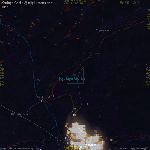
Analysis of Krutaya Gorka night lights 2016
Square area 10x10 km:
 0%
0%90-99
0%80-89
0%70-79
0%60-69
0%50-59
0%40-49
0%30-39
0%20-29
0%10-19
0%0-9
100%Square area 50x50 km:
0.01%90-99
0.01%80-89
0%70-79
0%60-69
0%50-59
0.07%40-49
0.08%30-39
0.04%20-29
0%10-19
0.16%0-9
99.62%Clear (daylight) street map image can be seen on geolist.org.
Map coordinates:
55° 45' 45.1" North, 72° 31' 11.9" East
55° 21' 53.7" North, 73° 13' 23.2" East
54° 57' 47.8" North, 73° 55' 34.4" East
Some cities around Krutaya Gorka sort by population:
• Omsk
42.4 km =26.3 mi,  167°
167°
• Lyubinskiy
41 km =25.5 mi,  235°
235°
• Kormilovka
68.9 km =42.8 mi,  125°
125°
• Luzino
47.9 km =29.8 mi,  194°
194°
• Sargatskoye
32.3 km =20.1 mi,  32°
32°
• Beregovoy
21.3 km =13.2 mi,  180°
180°
• Vkhodnoy
46.1 km =28.6 mi, 184°
• Krasnyy Yar
23.2 km =14.4 mi,  234°
234°
1501710 (p: 6,779)
Sources (retrieved 2019-11-25):
» Earth at Night: Flat Maps 2012, 2016