Lyskovo night lights from space
Night Light of Lyskovo (Nizhny Novgorod Oblast) from space (Russia) Src. Average luminocity for 10x10km area is 8.1128% and for 50x50km: 0.5344%.
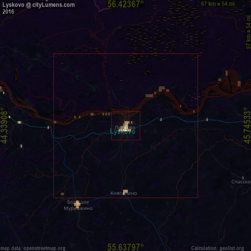
Analysis of Lyskovo night lights 2016
Square area 10x10 km:
 0%
0%90-99
0.63%80-89
0.88%70-79
1.63%60-69
3.38%50-59
1.63%40-49
1.63%30-39
0.25%20-29
0%10-19
0%0-9
89.97%Square area 50x50 km:
0%90-99
0.02%80-89
0.03%70-79
0.08%60-69
0.18%50-59
0.06%40-49
0.08%30-39
0.05%20-29
0.47%10-19
0%0-9
99.02%Clear (daylight) street map image can be seen on geolist.org.
Map coordinates:
56° 25' 25.2" North, 44° 20' 20.7" East
56° 1' 58.2" North, 45° 2' 31.9" East
55° 38' 16.7" North, 45° 44' 43.2" East
Some cities around Lyskovo sort by population:
• Kstovo
53.9 km =33.5 mi,  283°
283°
• Bor
69.9 km =43.4 mi,  301°
301°
• Sergach
61.8 km =38.4 mi,  154°
154°
• Perevoz
57.7 km =35.9 mi,  212°
212°
• Bol’shoye Murashkino
32.4 km =20.1 mi, 210°
• Knyaginino
23.4 km =14.5 mi,  181°
181°
• Buturlino
52.6 km =32.7 mi,  189°
189°
• Vorotynets
51.1 km =31.8 mi,  86°
86°
532715 (p: 23,570)
Sources (retrieved 2019-11-25):
» Earth at Night: Flat Maps 2012, 2016