Bol’shoye Murashkino night lights from space
Night Light of Bol’shoye Murashkino (Nizhny Novgorod Oblast) from space (Russia) Src. Average luminocity for 10x10km area is 3.1268% and for 50x50km: 0.3211%.
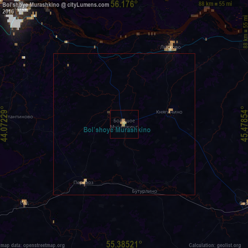
Analysis of Bol’shoye Murashkino night lights 2016
Square area 10x10 km:
 0%
0%90-99
0%80-89
0.48%70-79
0.72%60-69
2.63%50-59
0%40-49
0%30-39
0%20-29
0%10-19
0%0-9
96.17%Square area 50x50 km:
0%90-99
0%80-89
0.04%70-79
0.09%60-69
0.19%50-59
0.01%40-49
0.04%30-39
0.06%20-29
0%10-19
0%0-9
99.58%Clear (daylight) street map image can be seen on geolist.org.
Map coordinates:
56° 10' 33.6" North, 44° 4' 20.2" East
55° 46' 57.4" North, 44° 46' 31.5" East
55° 23' 6.8" North, 45° 28' 42.7" East
Some cities around Bol’shoye Murashkino sort by population:
• Arzamas
72.9 km =45.3 mi,  233°
233°
• Kstovo
54.2 km =33.7 mi,  318°
318°
• Lyskovo
32.4 km =20.1 mi,  30°
30°
• Sergach
51.6 km =32.1 mi,  122°
122°
• Perevoz
25.3 km =15.7 mi,  214°
214°
• Knyaginino
16.8 km =10.4 mi,  74°
74°
• Vad
45.2 km =28.1 mi, 231°
• Buturlino
25.2 km =15.7 mi,  162°
162°
573471 (p: 7,000)
Sources (retrieved 2019-11-25):
» Earth at Night: Flat Maps 2012, 2016