Lopatinskiy night lights from space
Night Light of Lopatinskiy (Moscow Oblast) from space (Russia) Src. Average luminocity for 10x10km area is 19.7548% and for 50x50km: 4.3013%.
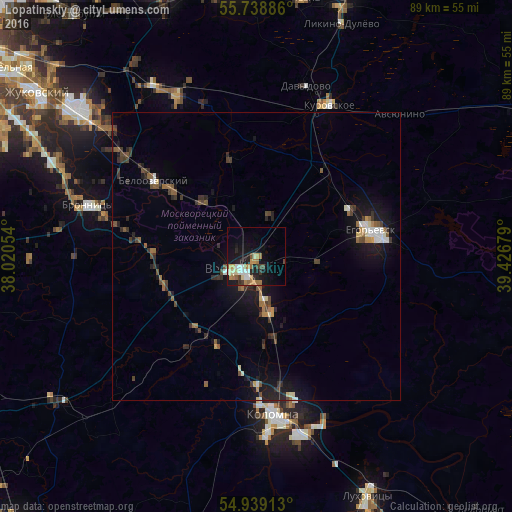
Analysis of Lopatinskiy night lights 2016
Square area 10x10 km:
 1.44%
1.44%90-99
3.59%80-89
2.63%70-79
2.15%60-69
5.5%50-59
1.44%40-49
1.79%30-39
2.03%20-29
3.71%10-19
18.78%0-9
56.94%Square area 50x50 km:
0.35%90-99
0.5%80-89
0.35%70-79
0.28%60-69
0.63%50-59
0.65%40-49
0.83%30-39
0.85%20-29
1.02%10-19
3.88%0-9
90.65%Clear (daylight) street map image can be seen on geolist.org.
Map coordinates:
55° 44' 19.9" North, 38° 1' 13.9" East
55° 20' 27.6" North, 38° 43' 25.2" East
54° 56' 20.9" North, 39° 25' 36.4" East
Some cities around Lopatinskiy sort by population:
• Kolomna
29.3 km =18.2 mi,  173°
173°
• Yegor’yevsk
20.1 km =12.5 mi,  76°
76°
• Voskresensk
5.2 km =3.2 mi,  239°
239°
• Kurovskoye
29.5 km =18.3 mi,  24°
24°
• Bronnitsy
30.5 km =19 mi,  286°
286°
• Beloozërskiy
22.1 km =13.7 mi,  306°
306°
• Davydovo
31 km =19.3 mi, 16°
• Konobeyevo
8.4 km =5.2 mi,  332°
332°
534174 (p: 14,219)
Sources (retrieved 2019-11-25):
» Earth at Night: Flat Maps 2012, 2016