Kovdor night lights from space
Night Light of Kovdor (Murmansk) from space (Russia) Src. Average luminocity for 10x10km area is 18.6327% and for 50x50km: 0.8121%.
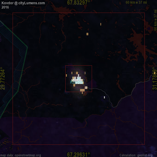
Analysis of Kovdor night lights 2016
Square area 10x10 km:
 5.19%
5.19%90-99
4%80-89
1.02%70-79
1.53%60-69
3.15%50-59
0.09%40-49
0.34%30-39
0%20-29
1.02%10-19
23.64%0-9
60.03%Square area 50x50 km:
0.2%90-99
0.16%80-89
0.04%70-79
0.06%60-69
0.16%50-59
0.02%40-49
0.01%30-39
0%20-29
0.04%10-19
0.97%0-9
98.34%Clear (daylight) street map image can be seen on geolist.org.
Map coordinates:
67° 49' 58.7" North, 29° 46' 21.5" East
67° 33' 58.2" North, 30° 28' 32.7" East
67° 17' 46.7" North, 31° 10' 44" East
Some cities around Kovdor sort by population:
• Apatity
124.2 km =77.2 mi,  90°
90°
• Monchegorsk
109.2 km =67.9 mi,  67°
67°
• Kandalaksha
94.3 km =58.6 mi,  118°
118°
• Kirovsk
135.6 km =84.3 mi, 87°
• Olenegorsk
132.9 km =82.6 mi,  61°
61°
• Polyarnyye Zori
89 km =55.3 mi,  104°
104°
• Zelenoborskiy
114.2 km =71 mi,  134°
134°
• Alakurtti
66.8 km =41.5 mi,  184°
184°
543508 (p: 19,518)
Sources (retrieved 2019-11-25):
» Earth at Night: Flat Maps 2012, 2016