Konobeyevo night lights from space
Night Light of Konobeyevo (Moscow Oblast) from space (Russia) Src. Average luminocity for 10x10km area is 1.2344% and for 50x50km: 5.1807%.
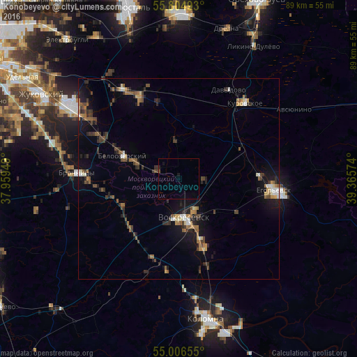
Analysis of Konobeyevo night lights 2016
Square area 10x10 km:
 0%
0%90-99
0%80-89
0%70-79
0%60-69
0%50-59
0.36%40-49
0.12%30-39
0%20-29
0.48%10-19
0.96%0-9
98.09%Square area 50x50 km:
0.32%90-99
0.51%80-89
0.43%70-79
0.45%60-69
0.96%50-59
0.86%40-49
1%30-39
1.15%20-29
1.22%10-19
3.9%0-9
89.17%Clear (daylight) street map image can be seen on geolist.org.
Map coordinates:
55° 48' 17.7" North, 37° 57' 34.2" East
55° 24' 27.9" North, 38° 39' 45.4" East
55° 0' 23.6" North, 39° 21' 56.7" East
Some cities around Konobeyevo sort by population:
• Yegor’yevsk
23.5 km =14.6 mi,  96°
96°
• Voskresensk
10.1 km =6.3 mi,  183°
183°
• Kurovskoye
25.2 km =15.7 mi,  39°
39°
• Bronnitsy
25.3 km =15.7 mi,  273°
273°
• Beloozërskiy
15 km =9.3 mi,  292°
292°
• Lopatinskiy
8.4 km =5.2 mi,  152°
152°
• Davydovo
25.6 km =15.9 mi,  29°
29°
• Gzhel’
28.1 km =17.5 mi,  323°
323°
545405 (p: 10,434)
Sources (retrieved 2019-11-25):
» Earth at Night: Flat Maps 2012, 2016