Komsomol’sk night lights from space
Night Light of Komsomol’sk (Ivanovo) from space (Russia) Src. Average luminocity for 10x10km area is 1.3909% and for 50x50km: 0.3322%.
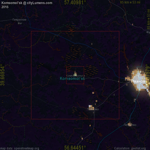
Analysis of Komsomol’sk night lights 2016
Square area 10x10 km:
 0%
0%90-99
0%80-89
0.23%70-79
0.23%60-69
0%50-59
0.11%40-49
1.59%30-39
0.11%20-29
0.45%10-19
0%0-9
97.27%Square area 50x50 km:
0.02%90-99
0.01%80-89
0.01%70-79
0.05%60-69
0.02%50-59
0.15%40-49
0.07%30-39
0.13%20-29
0.11%10-19
0%0-9
99.42%Clear (daylight) street map image can be seen on geolist.org.
Map coordinates:
57° 24' 35.3" North, 39° 40' 10.3" East
57° 1' 44.9" North, 40° 22' 21.6" East
56° 38' 40.2" North, 41° 4' 32.8" East
Some cities around Komsomol’sk sort by population:
• Ivanovo
36.4 km =22.6 mi,  95°
95°
• Furmanov
50.9 km =31.6 mi,  60°
60°
• Teykovo
21.5 km =13.4 mi,  152°
152°
• Kokhma
44.8 km =27.8 mi, 103°
• Nerekhta
49.3 km =30.6 mi,  14°
14°
• Gavrilov-Yam
43.6 km =27.1 mi,  314°
314°
• Novo-Talitsy
29.6 km =18.4 mi, 95°
• Lezhnevo
42.3 km =26.3 mi,  131°
131°
545736 (p: 8,975)
Sources (retrieved 2019-11-25):
» Earth at Night: Flat Maps 2012, 2016