Kirovskaya night lights from space
Night Light of Kirovskaya (Rostov) from space (Russia) Src. Average luminocity for 10x10km area is 0.5341% and for 50x50km: 3.7736%.
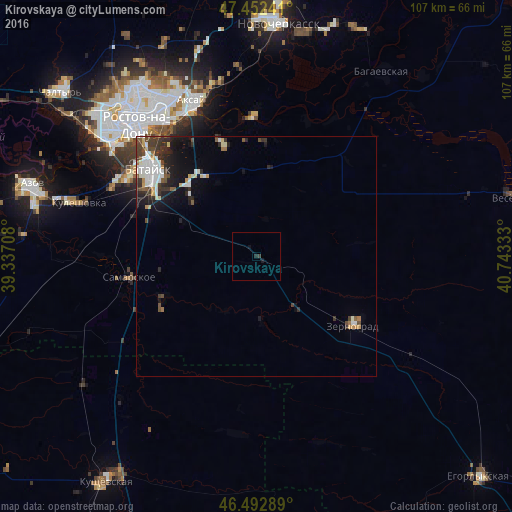
Analysis of Kirovskaya night lights 2016
Square area 10x10 km:
 0%
0%90-99
0%80-89
0%70-79
0%60-69
0%50-59
0%40-49
0%30-39
0.57%20-29
0.57%10-19
1.14%0-9
97.73%Square area 50x50 km:
0.69%90-99
0.82%80-89
0.32%70-79
0.29%60-69
0.2%50-59
0.38%40-49
0.57%30-39
0.92%20-29
1.09%10-19
2.26%0-9
92.48%Clear (daylight) street map image can be seen on geolist.org.
Map coordinates:
47° 27' 8.7" North, 39° 20' 13.5" East
46° 58' 29.3" North, 40° 2' 24.7" East
46° 29' 34.4" North, 40° 44' 36" East
Some cities around Kirovskaya sort by population:
• Bataysk
28.5 km =17.7 mi,  310°
310°
• Aksay
34.2 km =21.3 mi,  337°
337°
• Zernograd
25 km =15.5 mi,  125°
125°
• Samarskoye
27.1 km =16.8 mi,  261°
261°
• Kagal’nitskaya
13.2 km =8.2 mi,  142°
142°
• Ol’ginskaya
24.7 km =15.3 mi, 343°
• Novobataysk
21.4 km =13.3 mi,  246°
246°
• Starocherkasskaya
29.6 km =18.4 mi,  0°
0°
548390 (p: 5,918)
Sources (retrieved 2019-11-25):
» Earth at Night: Flat Maps 2012, 2016