Bataysk night lights from space
Night Light of Bataysk (Rostov) from space (Russia) Src. Average luminocity for 10x10km area is 54.402% and for 50x50km: 18.9705%.
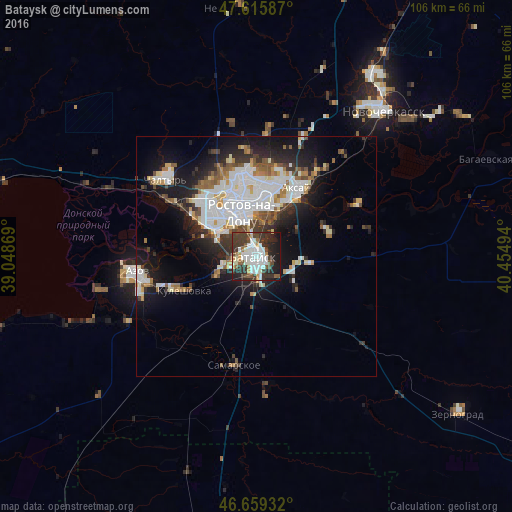
Analysis of Bataysk night lights 2016
Square area 10x10 km:
 13.49%
90-99
15.06%80-89
3.13%70-79
4.26%60-69
2.13%50-59
6.11%40-49
7.67%30-39
19.03%20-29
14.35%10-19
14.77%0-9
0%Square area 50x50 km:
4.98%90-99
4.37%80-89
1.46%70-79
1.37%60-69
1.55%50-59
2.14%40-49
1.85%30-39
2.68%20-29
4.85%10-19
10.31%0-9
64.44%Clear (daylight) street map image can be seen on geolist.org.
Map coordinates:
47° 36' 57.1" North, 39° 2' 55.3" East
47° 8' 23.1" North, 39° 45' 6.5" East
46° 39' 33.6" North, 40° 27' 17.8" East
Some cities around Bataysk sort by population:
• Rostov-na-Donu
10.4 km =6.5 mi,  348°
348°
• Azov
25.6 km =15.9 mi,  262°
262°
• Aksay
15.8 km =9.8 mi,  33°
33°
• Chaltyr
26 km =16.2 mi,  308°
308°
• Kuleshovka
16.2 km =10.1 mi,  244°
244°
• Samarskoye
23.1 km =14.4 mi,  192°
192°
• Ol’ginskaya
15.9 km =9.9 mi,  70°
70°
• Starocherkasskaya
24.6 km =15.3 mi,  62°
62°
578740 (p: 109,962)
Sources (retrieved 2019-11-25):
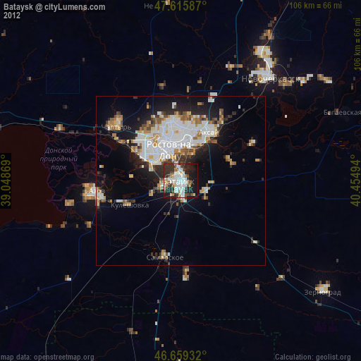
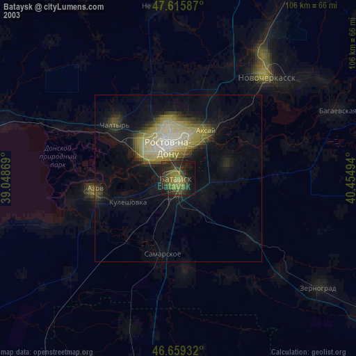
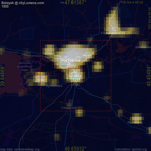
» NASA, Earths city lights 1995
» NASA city lights 2003
» Earth at Night: Flat Maps 2012, 2016