Khurba night lights from space
Night Light of Khurba (Khabarovsk) from space (Russia) Src. Average luminocity for 10x10km area is 4.381% and for 50x50km: 3.8016%.
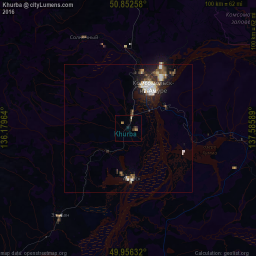
Analysis of Khurba night lights 2016
Square area 10x10 km:
 0%
0%90-99
0.56%80-89
0.42%70-79
0.7%60-69
0.56%50-59
0.84%40-49
1.96%30-39
0.84%20-29
0.84%10-19
0.84%0-9
92.44%Square area 50x50 km:
0.66%90-99
0.76%80-89
0.26%70-79
0.2%60-69
0.37%50-59
0.61%40-49
0.6%30-39
0.63%20-29
1.23%10-19
2.63%0-9
92.04%Clear (daylight) street map image can be seen on geolist.org.
Map coordinates:
50° 51' 9.3" North, 136° 10' 46.7" East
50° 24' 23.7" North, 136° 52' 57.9" East
49° 57' 22.8" North, 137° 35' 9.2" East
Some cities around Khurba sort by population:
• Khabarovsk
250.3 km =155.5 mi,  211°
211°
• Khabarovsk Vtoroy
252.8 km =157.1 mi, 210°
• Komsomolsk-on-Amur
18.3 km =11.4 mi,  29°
29°
• Amursk
18.9 km =11.7 mi,  180°
180°
• Solnechnyy
39.3 km =24.4 mi,  333°
333°
• Solnechnyy
22.4 km =13.9 mi, 28°
• Knyaze-Volkonskoye
239.2 km =148.6 mi, 205°
• Berëzovyy
164.1 km =102 mi, 328°
2022174 (p: 5,537)
Sources (retrieved 2019-11-25):
» Earth at Night: Flat Maps 2012, 2016