Khabarovsk Vtoroy night lights from space
Night Light of Khabarovsk Vtoroy (Khabarovsk) from space (Russia) Src. Average luminocity for 10x10km area is 70.5341% and for 50x50km: 10.0462%.
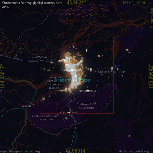
Analysis of Khabarovsk Vtoroy night lights 2016
Square area 10x10 km:
 22.16%
90-99
18.04%80-89
5.11%70-79
6.68%60-69
12.78%50-59
8.95%40-49
4.4%30-39
12.36%20-29
7.81%10-19
1.7%0-9
0%Square area 50x50 km:
2.15%90-99
1.97%80-89
0.67%70-79
0.94%60-69
1.57%50-59
1.26%40-49
1.19%30-39
1.68%20-29
2.76%10-19
4.76%0-9
81.04%Clear (daylight) street map image can be seen on geolist.org.
Map coordinates:
48° 54' 7.6" North, 134° 25' 48.6" East
48° 26' 15.9" North, 135° 7' 59.8" East
47° 58' 8.9" North, 135° 50' 11.1" East
Some cities around Khabarovsk Vtoroy sort by population:
• Birobidzhan
167.1 km =103.8 mi,  283°
283°
• Fuyuan, CN
62.9 km =39.1 mi,  262°
262°
• Vyazemskiy
104 km =64.6 mi,  195°
195°
• Khor
62.8 km =39 mi,  192°
192°
• Nekrasovka
12 km =7.5 mi,  142°
142°
• Knyaze-Volkonskoye
24 km =14.9 mi,  82°
82°
• Smidovich
99.1 km =61.6 mi, 280°
• Korfovskiy
24.5 km =15.2 mi, 192°
2056752 (p: 578,303)
Sources (retrieved 2019-11-25):
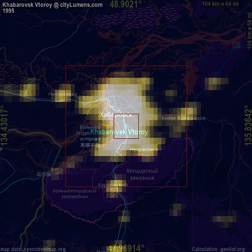
» NASA, Earths city lights 1995
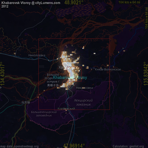
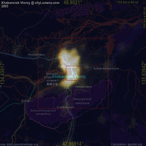
» NASA city lights 2003
» Earth at Night: Flat Maps 2012, 2016