Fryazevo night lights from space
Night Light of Fryazevo (Moscow Oblast) from space (Russia) Src. Average luminocity for 10x10km area is 21.9282% and for 50x50km: 17.7413%.
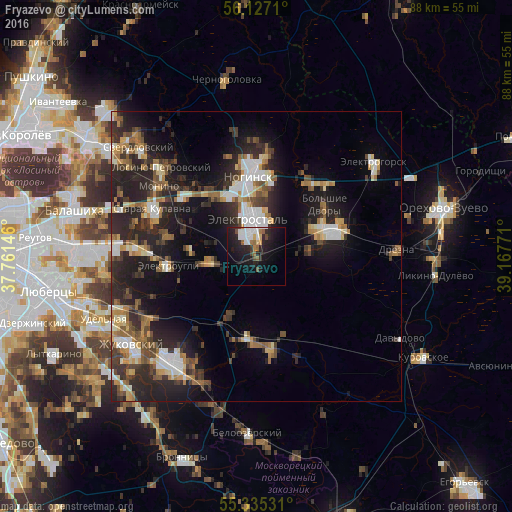
Analysis of Fryazevo night lights 2016
Square area 10x10 km:
 5.62%
5.62%90-99
3.47%80-89
1.2%70-79
0.96%60-69
2.51%50-59
1.79%40-49
2.51%30-39
1.2%20-29
9.81%10-19
21.53%0-9
49.4%Square area 50x50 km:
2.37%90-99
2.75%80-89
1.68%70-79
1.91%60-69
2.45%50-59
2.29%40-49
2.56%30-39
3.3%20-29
8.47%10-19
11.4%0-9
60.82%Clear (daylight) street map image can be seen on geolist.org.
Map coordinates:
56° 7' 37.6" North, 37° 45' 41.3" East
55° 43' 59.6" North, 38° 27' 52.5" East
55° 20' 7.1" North, 39° 10' 3.8" East
Some cities around Fryazevo sort by population:
• Elektrostal’
6.4 km =4 mi,  349°
349°
• Noginsk
14.9 km =9.3 mi, 354°
• Pavlovskiy Posad
12.8 km =8 mi,  65°
65°
• Staraya Kupavna
19.6 km =12.2 mi,  295°
295°
• Elektrougli
16 km =9.9 mi,  266°
266°
• Obukhovo
16.3 km =10.1 mi,  312°
312°
• Gzhel’
14.4 km =8.9 mi,  197°
197°
• Imeni Vorovskogo
8.8 km =5.5 mi, 269°
562321 (p: 53,212)
Sources (retrieved 2019-11-25):
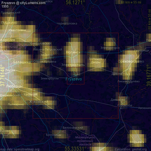
» NASA, Earths city lights 1995
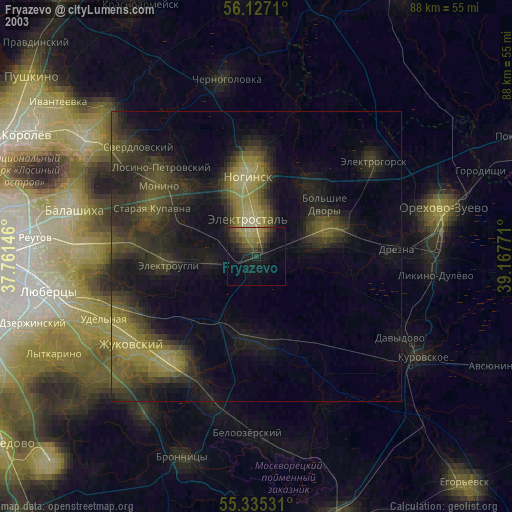
» NASA city lights 2003
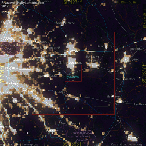
» Earth at Night: Flat Maps 2012, 2016