Pavlovskiy Posad night lights from space
Night Light of Pavlovskiy Posad (Moscow Oblast) from space (Russia) Src. Average luminocity for 10x10km area is 30.1148% and for 50x50km: 10.7436%.
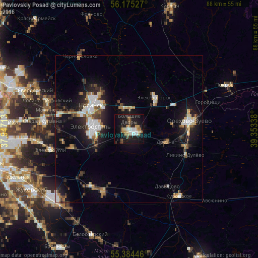
Analysis of Pavlovskiy Posad night lights 2016
Square area 10x10 km:
 4.43%
4.43%90-99
5.14%80-89
4.07%70-79
3.95%60-69
3.95%50-59
1.44%40-49
1.91%30-39
3.83%20-29
9.57%10-19
36.36%0-9
25.36%Square area 50x50 km:
1.77%90-99
1.76%80-89
1.07%70-79
1.03%60-69
1.36%50-59
1.05%40-49
1.17%30-39
1.5%20-29
3.17%10-19
8.08%0-9
78.05%Clear (daylight) street map image can be seen on geolist.org.
Map coordinates:
56° 10' 31" North, 37° 56' 49.7" East
55° 46' 54.7" North, 38° 39' 0.9" East
55° 23' 4.1" North, 39° 21' 12.2" East
Some cities around Pavlovskiy Posad sort by population:
• Elektrostal’
12.8 km =8 mi,  273°
273°
• Orekhovo-Zuyevo
19.7 km =12.2 mi,  81°
81°
• Noginsk
16 km =9.9 mi,  306°
306°
• Fryazevo
12.8 km =8 mi,  245°
245°
• Kabanovo
18.2 km =11.3 mi,  101°
101°
• Elektrogorsk
14.2 km =8.8 mi,  36°
36°
• Drezna
13.1 km =8.1 mi,  109°
109°
• Demikhovo
14.7 km =9.1 mi, 83°
512023 (p: 60,051)
Sources (retrieved 2019-11-25):
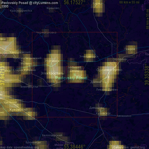
» NASA, Earths city lights 1995
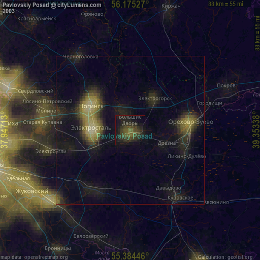
» NASA city lights 2003
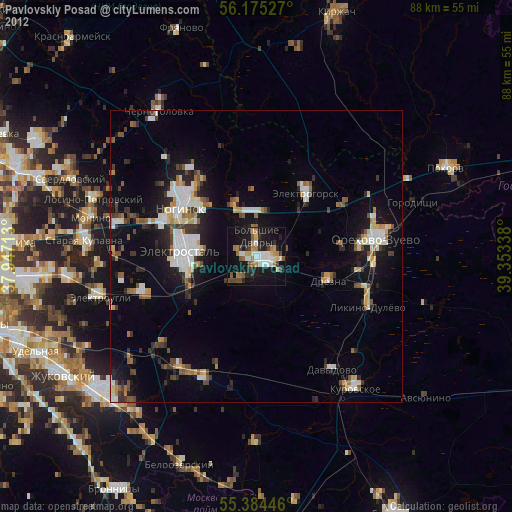
» Earth at Night: Flat Maps 2012, 2016