Finlyandskiy night lights from space
Night Light of Finlyandskiy (Leningradskaya Oblast') from space (Russia) Src. Average luminocity for 10x10km area is 98.2652% and for 50x50km: 53.7445%.
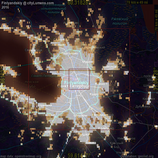
Analysis of Finlyandskiy night lights 2016
Square area 10x10 km:
 94.7%
94.7%90-99
0.54%80-89
0%70-79
0%60-69
4.76%50-59
0%40-49
0%30-39
0%20-29
0%10-19
0%0-9
0%Square area 50x50 km:
24.22%90-99
11.21%80-89
4.35%70-79
4.79%60-69
3.91%50-59
2.41%40-49
2.35%30-39
5.06%20-29
10.29%10-19
12.21%0-9
19.2%Clear (daylight) street map image can be seen on geolist.org.
Map coordinates:
60° 19' 5.8" North, 29° 39' 39.7" East
59° 58' 5.7" North, 30° 21' 50.9" East
59° 36' 52.1" North, 31° 4' 2.2" East
Some cities around Finlyandskiy sort by population:
• Saint Petersburg
4.3 km =2.7 mi,  220°
220°
• Kalininskiy
3.5 km =2.2 mi,  24°
24°
• Centralniy
4.1 km =2.5 mi,  182°
182°
• Petrogradka
2.9 km =1.8 mi,  264°
264°
• Svetlanovskiy
4.3 km =2.7 mi,  334°
334°
• Chernaya Rechka
3.9 km =2.4 mi,  300°
300°
• Sampsonievskiy
2.2 km =1.4 mi, 327°
• Novaya Derevnya
4.8 km =3 mi, 296°
8504959 (p: 72,292)
Sources (retrieved 2019-11-25):
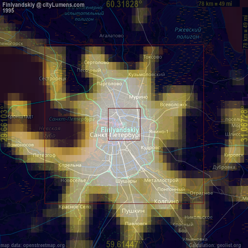
» NASA, Earths city lights 1995
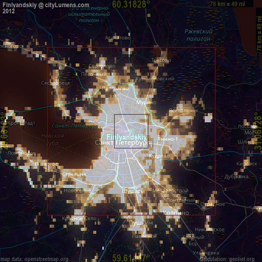
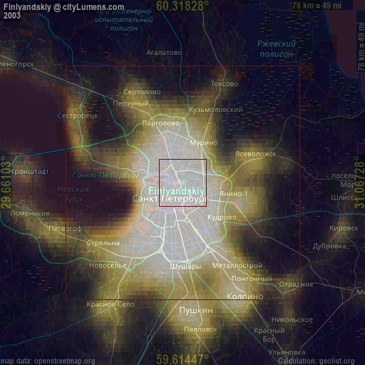
» NASA city lights 2003
» Earth at Night: Flat Maps 2012, 2016