Chernaya Rechka night lights from space
Night Light of Chernaya Rechka (Leningradskaya Oblast') from space (Russia) Src. Average luminocity for 10x10km area is 97.9545% and for 50x50km: 53.2046%.
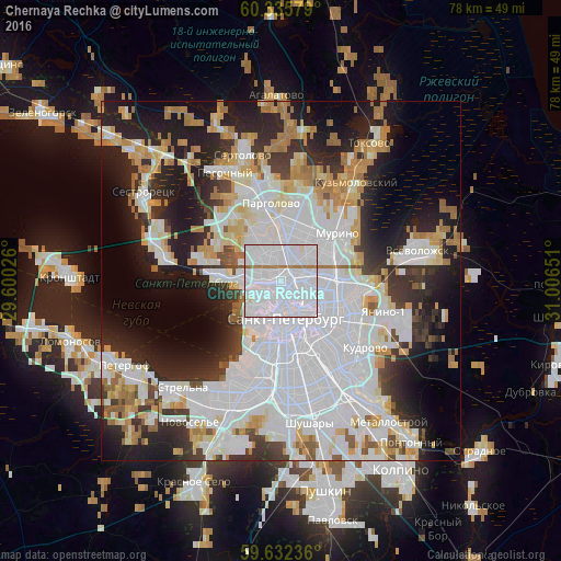
Analysis of Chernaya Rechka night lights 2016
Square area 10x10 km:
 85.61%
90-99
8.98%80-89
0.43%70-79
0%60-69
4.44%50-59
0.54%40-49
0%30-39
0%20-29
0%10-19
0%0-9
0%Square area 50x50 km:
23.32%90-99
10.83%80-89
4.43%70-79
5%60-69
4.54%50-59
2.43%40-49
2.14%30-39
4.76%20-29
10.49%10-19
14.01%0-9
18.04%Clear (daylight) street map image can be seen on geolist.org.
Map coordinates:
60° 20' 8.8" North, 29° 36' 0.9" East
59° 59' 9.4" North, 30° 18' 12.2" East
59° 37' 56.5" North, 31° 0' 23.4" East
Some cities around Chernaya Rechka sort by population:
• Petrogradka
2.3 km =1.4 mi,  168°
168°
• Svetlanovskiy
2.4 km =1.5 mi,  38°
38°
• Komendantsky aerodrom
2.6 km =1.6 mi,  322°
322°
• Finlyandskiy
3.9 km =2.4 mi,  120°
120°
• Sampsonievskiy
2.2 km =1.4 mi,  92°
92°
• Staraya Derevnya
3.4 km =2.1 mi,  274°
274°
• Krestovskiy ostrov
3 km =1.9 mi,  236°
236°
• Novaya Derevnya
0.9 km =0.6 mi,  280°
280°
8504946 (p: 56,429)
Sources (retrieved 2019-11-25):
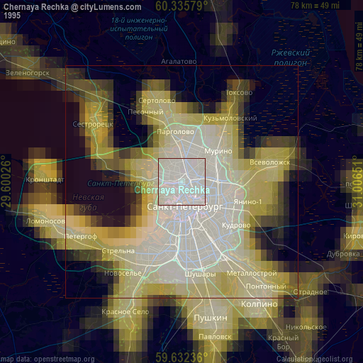
» NASA, Earths city lights 1995
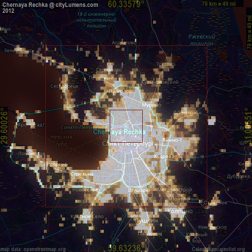
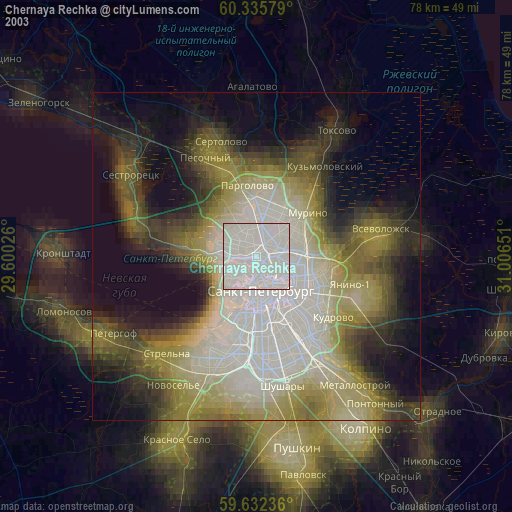
» NASA city lights 2003
» Earth at Night: Flat Maps 2012, 2016