Svetlanovskiy night lights from space
Night Light of Svetlanovskiy (Leningradskaya Oblast') from space (Russia) Src. Average luminocity for 10x10km area is 98.1223% and for 50x50km: 51.2103%.
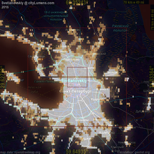
Analysis of Svetlanovskiy night lights 2016
Square area 10x10 km:
 87.55%
90-99
7.47%80-89
0.22%70-79
0%60-69
4.76%50-59
0%40-49
0%30-39
0%20-29
0%10-19
0%0-9
0%Square area 50x50 km:
22.77%90-99
10.05%80-89
4.26%70-79
4.81%60-69
4.59%50-59
2.29%40-49
1.92%30-39
4.28%20-29
9.87%10-19
13.65%0-9
21.52%Clear (daylight) street map image can be seen on geolist.org.
Map coordinates:
60° 21' 8.7" North, 29° 37' 38.6" East
60° 0' 9.9" North, 30° 19' 49.8" East
59° 38' 57.7" North, 31° 2' 1.1" East
Some cities around Svetlanovskiy sort by population:
• Kalininskiy
3.4 km =2.1 mi,  101°
101°
• Akademicheskoe
3.8 km =2.4 mi,  71°
71°
• Komendantsky aerodrom
3.1 km =1.9 mi,  273°
273°
• Sosnovka
1.9 km =1.2 mi,  35°
35°
• Chernaya Rechka
2.4 km =1.5 mi,  218°
218°
• Kolomyagi
3.5 km =2.2 mi,  313°
313°
• Sampsonievskiy
2.1 km =1.3 mi,  160°
160°
• Novaya Derevnya
3 km =1.9 mi,  235°
235°
8504964 (p: 85,508)
Sources (retrieved 2019-11-25):
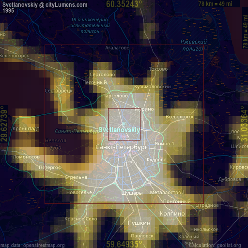
» NASA, Earths city lights 1995
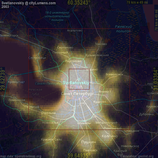
» NASA city lights 2003
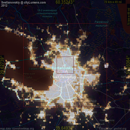
» Earth at Night: Flat Maps 2012, 2016