Domna night lights from space
Night Light of Domna (Transbaikal Territory) from space (Russia) Src. Average luminocity for 10x10km area is 3.6944% and for 50x50km: 4.0284%.
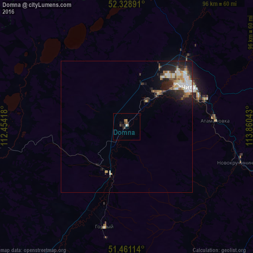
Analysis of Domna night lights 2016
Square area 10x10 km:
 0%
0%90-99
0.51%80-89
0%70-79
0.51%60-69
1.14%50-59
0.38%40-49
1.14%30-39
0.51%20-29
1.89%10-19
1.52%0-9
92.42%Square area 50x50 km:
0.69%90-99
0.87%80-89
0.35%70-79
0.41%60-69
0.54%50-59
0.4%40-49
0.45%30-39
0.65%20-29
1.35%10-19
2.56%0-9
91.75%Clear (daylight) street map image can be seen on geolist.org.
Map coordinates:
52° 19' 44.1" North, 112° 27' 15" East
51° 53' 49.6" North, 113° 9' 26.3" East
51° 27' 40.1" North, 113° 51' 37.5" East
Some cities around Domna sort by population:
• Chita
27.9 km =17.3 mi,  57°
57°
• Aginskoye
129.9 km =80.7 mi,  133°
133°
• Karymskoye
87.8 km =54.6 mi,  110°
110°
• Novokruchininskiy
44.3 km =27.5 mi, 106°
• Atamanovka
32.9 km =20.4 mi,  82°
82°
• Darasun
62.2 km =38.6 mi,  115°
115°
• Ulety
76 km =47.2 mi,  217°
217°
• Sosnovo-Ozerskoye
130.3 km =81 mi,  302°
302°
2024893 (p: 6,576)
Sources (retrieved 2019-11-25):
» Earth at Night: Flat Maps 2012, 2016