Borodino night lights from space
Night Light of Borodino (Krasnoyarskiy) from space (Russia) Src. Average luminocity for 10x10km area is 28.0238% and for 50x50km: 3.5946%.
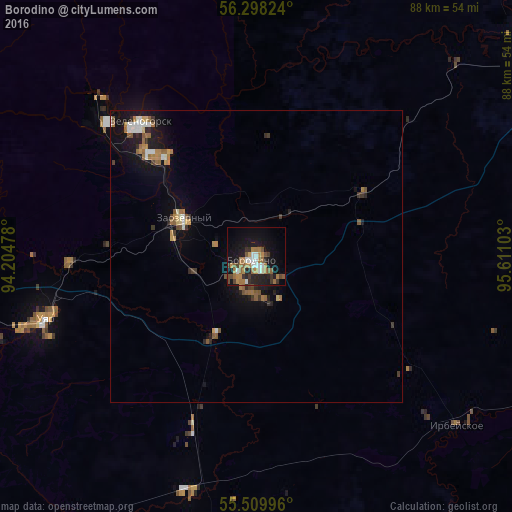
Analysis of Borodino night lights 2016
Square area 10x10 km:
 3.01%
3.01%90-99
3.88%80-89
0.13%70-79
5.51%60-69
8.27%50-59
4.26%40-49
3.38%30-39
3.76%20-29
6.89%10-19
23.18%0-9
37.72%Square area 50x50 km:
0.34%90-99
0.48%80-89
0.14%70-79
0.55%60-69
0.82%50-59
0.62%40-49
0.3%30-39
0.54%20-29
0.72%10-19
3.11%0-9
92.39%Clear (daylight) street map image can be seen on geolist.org.
Map coordinates:
56° 17' 53.7" North, 94° 12' 17.2" East
55° 54' 22" North, 94° 54' 28.4" East
55° 30' 35.9" North, 95° 36' 39.7" East
Some cities around Borodino sort by population:
• Kansk
60.1 km =37.3 mi,  56°
56°
• Zheleznogorsk
93.6 km =58.2 mi,  294°
294°
• Zelenogorsk
29.9 km =18.6 mi,  320°
320°
• Sosnovoborsk
100.4 km =62.4 mi,  283°
283°
• Ilanskiy
80.5 km =50 mi, 63°
• Uyar
37.9 km =23.5 mi,  253°
253°
• Dzerzhinskoye
105.1 km =65.3 mi,  10°
10°
• Aginskoye
72 km =44.7 mi,  180°
180°
1508943 (p: 19,602)
Sources (retrieved 2019-11-25):
» Earth at Night: Flat Maps 2012, 2016