Ansalta night lights from space
Night Light of Ansalta (Dagestan) from space (Russia) Src. Average luminocity for 10x10km area is 4.45% and for 50x50km: 0.9815%.
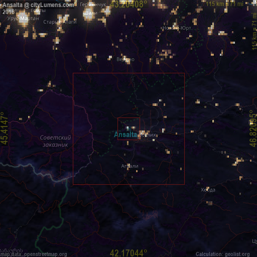
Analysis of Ansalta night lights 2016
Square area 10x10 km:
 0%
0%90-99
0.76%80-89
0.76%70-79
0%60-69
1.06%50-59
1.06%40-49
0%30-39
0.61%20-29
1.82%10-19
0.61%0-9
93.33%Square area 50x50 km:
0.01%90-99
0.19%80-89
0.1%70-79
0.07%60-69
0.18%50-59
0.23%40-49
0.28%30-39
0.14%20-29
0.13%10-19
0.09%0-9
98.58%Clear (daylight) street map image can be seen on geolist.org.
Map coordinates:
43° 12' 14.7" North, 45° 24' 52.9" East
42° 41' 21.9" North, 46° 7' 4.2" East
42° 10' 13.6" North, 46° 49' 15.4" East
Some cities around Ansalta sort by population:
• Shali
53.9 km =33.5 mi,  340°
340°
• Avtury
53.6 km =33.3 mi,  349°
349°
• Untsukul’
54.7 km =34 mi,  87°
87°
• Duba-Yurt
49.8 km =30.9 mi,  320°
320°
• Tsentoroy
36.3 km =22.6 mi,  13°
13°
• Andi
15.7 km =9.8 mi,  48°
48°
• Chiri-Yurt
53.9 km =33.5 mi,  325°
325°
• Nozhay-Yurt
49.6 km =30.8 mi,  25°
25°
581568 (p: 5,654)
Sources (retrieved 2019-11-25):
» Earth at Night: Flat Maps 2012, 2016