Andi night lights from space
Night Light of Andi (Dagestan) from space (Russia) Src. Average luminocity for 10x10km area is 2.8545% and for 50x50km: 1.8331%.
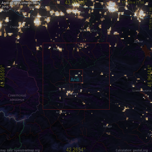
Analysis of Andi night lights 2016
Square area 10x10 km:
 0%
0%90-99
0.61%80-89
0.61%70-79
0%60-69
0.15%50-59
1.21%40-49
0.91%30-39
0.61%20-29
0%10-19
0.3%0-9
95.61%Square area 50x50 km:
0.03%90-99
0.29%80-89
0.15%70-79
0.23%60-69
0.28%50-59
0.43%40-49
0.48%30-39
0.43%20-29
0.27%10-19
0.29%0-9
97.13%Clear (daylight) street map image can be seen on geolist.org.
Map coordinates:
43° 17' 50.9" North, 45° 33' 30.9" East
42° 47' 0.9" North, 46° 15' 42.2" East
42° 15' 55.4" North, 46° 57' 53.4" East
Some cities around Andi sort by population:
• Avtury
47.2 km =29.3 mi,  333°
333°
• Mayrtup
47.9 km =29.8 mi,  347°
347°
• Dylym
44.1 km =27.4 mi,  43°
43°
• Leninaul
42.6 km =26.5 mi, 36°
• Untsukul’
43.6 km =27.1 mi,  100°
100°
• Tsentoroy
25 km =15.5 mi, 352°
• Ansalta
15.7 km =9.8 mi,  228°
228°
• Nozhay-Yurt
35.7 km =22.2 mi,  15°
15°
582123 (p: 5,318)
Sources (retrieved 2019-11-25):
» Earth at Night: Flat Maps 2012, 2016